2023 Map of Lake Placid
USGS Topo · Published 2023About this map
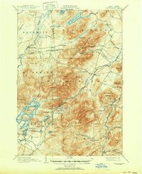
Lake Placid dominates the landscape north of the village, its irregular shoreline defined by prominent features like Moose Island and the narrow passage at Shelter Strait. To the south, the village center is bounded by the shores of Mirror Lake and the winding course of the Chubb River, while the high peaks of the Sentinel Range and Whiteface Mountain tower over the surrounding Adirondack terrain. This modern survey illustrates the proximity of the local infrastructure to significant historical sites, notably the North Elba Cemetery and John Browns Grave located near Bear Cub Lane. A network of contemporary roads and trails, such as the Whiteface Mountain Trail and Loggers Loop Trl, provides access to remote water bodies like Connery Pond and Owen Pond, highlighting the enduring connection between the settlement and the wilderness of the Adirondack Park Preserve.
Find a feature on this map
119 named features on this map. Tap any name to fly to it.
Don’t see what you’re looking for? This feature index may not catch every label — zoom into the map to look around manually.
Map Details
Editions of this 2023 Lake Placid Map
This is the sole edition of this map. No revisions or reprints were ever made.
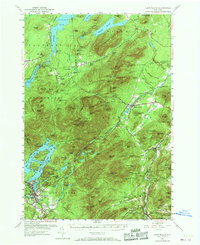
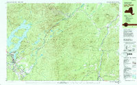
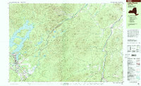
Historical Maps of Undercliff Through Time
6 maps found