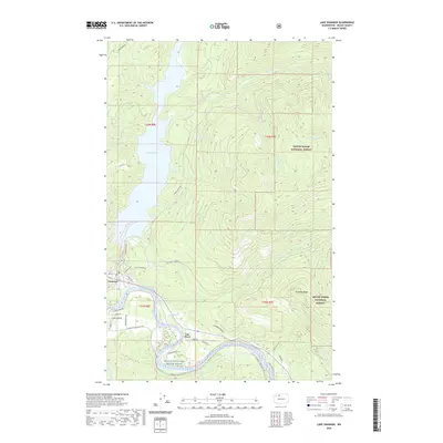
2020 Map of Lake Shannon
USGS Topo · Published 2020About this map
Lake Shannon dominates the western half of this Skagit County landscape, formed by the damming of the Baker River. Along its southern shore, the settlement of Concrete serves as a local hub, where residents navigate streets like Main St and N Everett Ave. To the east, the community of Van Horn sits near the confluence of Jackman Cr and the Skagit Wild and Scenic River. The terrain rises sharply away from these river valleys into the protected lands of the Mount Baker National Forest, characterized by steep drainages like Thunder Cr and the high elevation of Jackman Ridge. This map illustrates the intersection of industrial water management and forest preservation, with logging roads such as Baker Lake Rd and Jackman Creek Rd providing access to the interior wilderness and the high Thunder Lakes.
Find a feature on this map
41 named features on this map. Tap any name to fly to it.
Don’t see what you’re looking for? This feature index may not catch every label — zoom into the map to look around manually.
Map Details
Editions of this 2020 Lake Shannon Map
This is the sole edition of this map. No revisions or reprints were ever made.
Other maps of this area

1899 · Stillaguamish
USGS Topo · 1:125,000

1901 · Stilaguamish
USGS Topo · 1:125,000

1909 · Mt Baker
USGS Topo · 1:192,000

1915 · Mt. Baker
USGS Topo · 1:250,000

1952 · Lake Shannon
USGS Topo · 1:62,500

1952 · Hamilton
USGS Topo · 1:62,500

1955 · Concrete
USGS Topo · 1:250,000

1956 · Oso
USGS Topo · 1:62,500

1958 · Concrete
USGS Topo · 1:250,000

1962 · Concrete
USGS Topo · 1:250,000