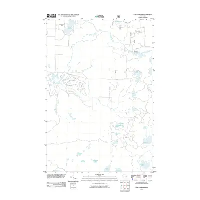
2011 Map of Lake Tahkodah
USGS Topo · Published 2011About this map
Lake Tahkodah and the surrounding Northwoods of Bayfield County are defined by a complex network of glacial kettle lakes and the meandering Namekagon River. The river, which flows through the northern and eastern portions of the quadrangle, is regulated by the Namekagon WP320 Dam. This 2011 survey captures the area's transition into a recreation-focused landscape, with the Tahkodah Hills Golf Course established near the lake's northern shore. Aviation access is provided by the Cable Union Airport in the western section, while the southern half of the map is dominated by numerous smaller water bodies including Frels Lake, Camp Four Lake, and Wilson Lake. The local infrastructure remains primarily rural, with roads like County Hwy M and Dam Rd connecting the scattered lakeside properties and providing access to the deep forested interior between Fivemile Creek and Cap Creek.
Find a feature on this map
52 named features on this map. Tap any name to fly to it.
Don’t see what you’re looking for? This feature index may not catch every label — zoom into the map to look around manually.
Map Details
Editions of this 2011 Lake Tahkodah Map
This is the sole edition of this map. No revisions or reprints were ever made.
Other maps of this area

1943 · Namekagon Lake
USGS Topo · 1:48,000

1944 · Drummond
USGS Topo · 1:48,000

1944 · Grandview
USGS Topo · 1:48,000

1944 · Hayward
USGS Topo · 1:48,000

1945 · Namekagon Lake
USGS Topo · 1:48,000

1947 · Drummond
USGS Topo · 1:48,000

1947 · Grandview
USGS Topo · 1:48,000

1953 · Ashland
USGS Topo · 1:250,000

1958 · Ashland
USGS Topo · 1:250,000
1971 · Cable
USGS Topo · 1:24,000