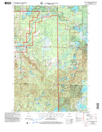
2005 Map of Lake Tahkodah
USGS Topo · Published 2006About this map
St Croix National Scenic Riverway protects the winding path of the Namekagon River as it moves through the glacial terrain of Bayfield County. By 2005, the landscape is defined by the deep integration of recreational infrastructure within the Chequamegon-Nicolet National Forest, most notably at Mount Telemark and the Rock Lake Semi-Primitive Non-Motorized Area. The map documents a dense network of water bodies, from Lake Tahkodah in the north to the sprawling Spider Lake and Wilson Lake in the south.
Find a feature on this map
43 named features on this map. Tap any name to fly to it.
Don’t see what you’re looking for? This feature index may not catch every label — zoom into the map to look around manually.
Map Details
Editions of this 2005 Lake Tahkodah Map
This is the sole edition of this map. No revisions or reprints were ever made.
Other maps of this area

1943 · Namekagon Lake
USGS Topo · 1:48,000

1944 · Drummond
USGS Topo · 1:48,000

1944 · Grandview
USGS Topo · 1:48,000

1944 · Hayward
USGS Topo · 1:48,000

1945 · Namekagon Lake
USGS Topo · 1:48,000

1947 · Drummond
USGS Topo · 1:48,000

1947 · Grandview
USGS Topo · 1:48,000

1953 · Ashland
USGS Topo · 1:250,000

1958 · Ashland
USGS Topo · 1:250,000
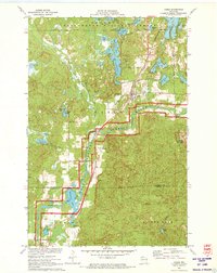
1971 · Cable
USGS Topo · 1:24,000