2024 Map of Lake Wales
USGS Topo · Published 2024About this map
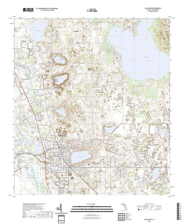
Lake Wales and the surrounding citrus-growing country of the Lake Wales Ridge are defined by a complex mosaic of freshwater basins and elevated terrain. Dominating the central landscape, Iron Mtn rises above a series of smaller water bodies including Mountain Lake, Lake Caroline, and Lake Edward. This area represents a well-developed interior corridor of Polk County, where residential settlements like Dundee and Lake of the Hills are interwoven with an extensive network of named lakes. The presence of the Peace Creek Drainage Canal and the Lake Wales Municipal Airport indicates a landscape shaped by both water management and modern infrastructure. Local heritage is preserved at sites like the Willow Lawn Cem and Lake Wales Cem, while education is anchored by the Polk State College - J D Alexander Center near the downtown core.
Find a feature on this map
63 named features on this map. Tap any name to fly to it.
Don’t see what you’re looking for? This feature index may not catch every label — zoom into the map to look around manually.
Map Details
Editions of this 2024 Lake Wales Map
This is the sole edition of this map. No revisions or reprints were ever made.