Old Maps of Polk County, Florida
Explore 279 old maps of Polk County, spanning from 1944 to today. These high-resolution historic maps reveal how streets, neighborhoods, landmarks, and natural features evolved over time — perfect for genealogy, metal detecting, research, and local history exploration.
What you can do with these maps:
- See how Polk County changed over time: Compare historical maps to modern-day views to trace roads, homesites, rail lines & more.
- View detailed metadata: Each map includes creators, publishers, year, scale, and archive source.
- Overlay maps with satellite & LiDAR: Visualize the past alongside modern tools to explore terrain & human change.
- Trusted historical sources: Maps sourced from the USGS, Library of Congress, and other archives.
- Access maps your way: View online, download high-res files, or order prints for personal or research use.
Start exploring old maps of Polk County to uncover forgotten places, hidden landmarks, and the deep history beneath your feet.
Polk County, FL maps
(279)- 1944 Map of Plant City
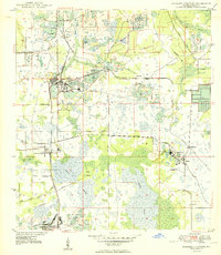
 1944 Plant City1944 Print · USGSMid-century Hillsborough and Polk counties are captured here during a time of significant military activity. Researchers can find old Florida landmarks like Enon Church, the Winston School, and the wartime footprints of Drane Field US Army.2 unique versions available
 - 1944 Map of Providence
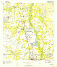
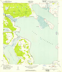
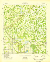 1944 Providence1944 Print · USGSPolk County during the Second World War reveals a landscape of emerging airfields and evolving citrus-belt infrastructure. Genealogists and researchers can trace the roads around Providence and Orangedale, or locate the wartime Auxiliary Landing Field.2 unique versions available
 - 1944 Map of Polk City
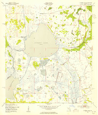
 1944 Polk City1944 Print · USGSCentral Florida’s lake country is captured in detail during the mid-forties, showing the established grid of Polk City. Researchers can trace early residential patterns near the shores of Lake Helene and explore the surrounding wetland and orchard landscape.2 unique versions available
 - 1944 Map of Lakeland
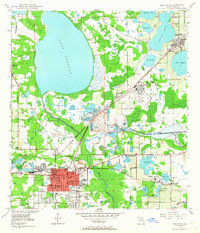
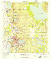
 1944 Lakeland1944 Print · USGSMid-century Lakeland is a hub of citrus, phosphate, and rail activity just as the wartime economy was peaking. Genealogists can trace family connections to Gibsonia and Eaton Park or locate the Roselawn Cem, Gapway Ch, and Combee School.2 unique versions available
 - 1944 Map of Auburndale
 1944 Auburndale1944 Print · USGSPolk County was a hub of citrus and industry during the mid-forties, characterized by its dense lake systems and rail junctions. You can trace family homesteads near Fussells Corner, locate the old Phosphate Mines, and see the early footprints of the Winter Haven Airport.2 unique versions available
 - 1944 Map of Socrum
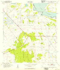
 1944 Socrum1944 Print · USGSCentral Florida's interior at the height of the war era reveals a landscape of citrus groves and cypress swamps at the tri-county corner. Genealogists and historians can trace old homesteads and landmarks like Bethel Church, the settlement of Socrum, and the Atlantic Coast Line tracks.2 unique versions available
 - 1949 Map of Mulberry, 1964 Print
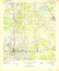
 1949 Mulberry1964 Print · USGSMid-century Polk County emerges as a hub of industry and settlement just after the war years. Genealogists and historians can trace the development of Mulberry and Highland City while locating family landmarks like Fitzgerald Cem or Medulla Ch.5 unique versions available
 - 1949 Map of Bartow, 1964 Print
 1949 Bartow1964 Print · USGSMid-century Bartow and the surrounding phosphate country are shown here just as industrial mining began to reshape the landscape. Genealogists and historians can locate Union Academy, trace the old Atlantic Coast Line tracks, or find family plots in Oak Hill Cem.5 unique versions available
 - 1949 Map of Bradley Junction, 1966 Print
 1949 Bradley Junction1966 Print · USGSPolk County was a hub of Florida phosphate production at mid-century, where rail lines and mining operations intersected with rural prairie life. Researchers can trace the industrial footprint of Pierce and Brewster alongside sites like Old Elam Ch and Mt Olive Cem.3 unique versions available
 - 1950 Map of Mulberry
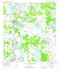
 1950 Mulberry1950 Print · USGSThe phosphate mining district around Mulberry is captured here at mid-century, showing a landscape defined by industry and rail. Genealogists and historians can trace old settlements like Tancrede and locate rural landmarks such as Medulla Ch and Prairie Cem.
 - 1950 Map of Bartow
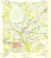 1950 Bartow1950 Print · USGSMid-century Bartow and the central Florida phosphate district are seen here during a period of industrial expansion. Genealogists and researchers can locate old schools like Union Academy, rural churches like Macedonia Ch, and the sprawling Strip Mine Area that reshaped the local terrain.
 - 1950 Map of Bradley Junction
 1950 Bradley Junction1950 Print · USGSMid-century Polk County is defined here by its massive phosphate industry and the tight-knit railroad towns that supported it. Trace the extensive rail network connecting Bradley Junction to mining hubs like Agricola and the company town of Brewster.
 - 1952 Map of Homeland, 1953 Print
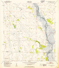
 1952 Homeland1953 Print · USGSIn the early 1950s, the landscape around Fort Meade and Homeland was defined by the transition from river-bottom wetlands to large-scale phosphate mining. Researchers can trace family history through Evergreen Cem and Hancock Cem, or follow the industrial growth at the Noralyn Mine and Pembroke landing field.5 unique versions available
 - 1952 Map of Lake Wales, 1953 Print
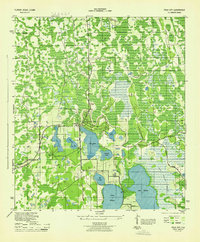
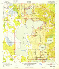
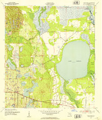
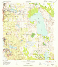
 1952 Lake Wales1953 Print · USGSThe Florida ridge country comes into focus in the early fifties, showcasing a landscape of citrus groves and interconnected lakes. Trace the intersecting tracks of the Atlantic Coast Line and landmarks like Bok Tower and Roosevelt Sch.9 unique versions available
 - 1952 Map of Lake Weohyakapka SE, 1953 Print
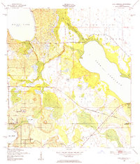
 1952 Lake Weohyakapka SE1953 Print · USGSCentral Florida's lake country in the early fifties shows a landscape of wetlands and early transport corridors at the Polk and Osceola county line. Researchers can trace the path of an Old Railroad Grade or explore the shoreline of Brahma Island and Lake Kissimmee.5 unique versions available
 - 1952 Map of Lake Weohyakapka NE, 1953 Print
 1952 Lake Weohyakapka NE1953 Print · USGSOsceola and Polk counties appear here in the early fifties, showing the expansive wetland systems of the Florida interior. Researchers can trace the original shoreline and named features like Sturm Island, Brahma Island, and the winding Kissimmee River.4 unique versions available
 - 1952 Map of Fort Kissimmee NW, 1953 Print
 1952 Fort Kissimmee NW1953 Print · USGSCentral Florida's interior in the early fifties is captured here as a landscape of military range lands and winding river wetlands. Researchers can trace the original path of the Kissimmee River and explore named landmarks like Hard Luck Hammock and Ice Cream Slough.3 unique versions available
 - 1952 Map of Lake Arbuckle NE, 1953 Print
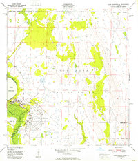 1952 Lake Arbuckle NE1953 Print · USGSAcross the Polk and Highlands county line in the early fifties, this area was defined by the massive footprint of the Avon Park Air Force Base. Researchers can trace the Government Railroad and the engineering of the Rim Canal along Lake Arbuckle.4 unique versions available
 - 1952 Map of Babson Park, 1953 Print
 1952 Babson Park1953 Print · USGSPolk County at mid-century reveals a landscape of citrus groves and interconnected lakes just as local infrastructure was expanding. Trace the routes of the Seaboard Air Line and find landmarks like Bethel Ch or the settlement at Frostproof.3 unique versions available
 - 1952 Map of Hesperides, 1953 Print
 1952 Hesperides1953 Print · USGSPolk County at the start of the 1950s was a landscape defined by expansive lakes and the citrus-belt rail lines. Genealogists and historians can trace local landmarks like the St Anne Shrine and Beulah Ch or the rural stops at Alcoma and Hesperides.4 unique versions available
 - 1952 Map of Lake Arbuckle, 1953 Print
 1952 Lake Arbuckle1953 Print · USGSThe Florida interior during the early fifties reveals a landscape shaped by military expansion and natural hydrology. Genealogists and historians can trace the U S Government Railroad and the small settlement of Alpine near Lake Pythias.3 unique versions available
 - 1952 Map of Lake Weohyakapka, 1953 Print
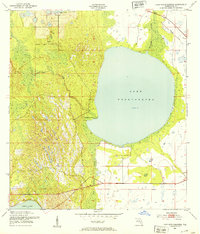 1952 Lake Weohyakapka1953 Print · USGSPolk County, Florida, in the early fifties shows a landscape of expansive wetlands and early rail transit. You can trace the path of the Seaboard Air Line Railroad and explore the natural margins of Tiger Creek Hammock and Blue Jordan Swamp.4 unique versions available
 - 1953 Map of Frostproof, 1954 Print
 1953 Frostproof1954 Print · USGSFrostproof and the surrounding Florida lake country are shown in the early fifties as the region's citrus and rail economy flourished. Researchers can trace the junction of the Seaboard Air Line and find rural landmarks like Maxcy Quarters and Corinth Ch.5 unique versions available
 - 1953 Map of Cypress Lake, 1954 Print
 1953 Cypress Lake1954 Print · USGSOsceola and Polk counties meet in this mid-century survey of the Florida wetlands before extensive modern development altered the region's hydrology. Genealogists and local historians can trace family-named landmarks like Ike Hammock, Johnson Island, and the early route of Canoe Creek Road.4 unique versions available
 - 1953 Map of Dundee, 1954 Print
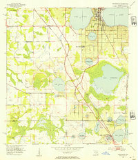
 1953 Dundee1954 Print · USGSHaines City and Dundee sit at the heart of this early 1950s survey of Polk County's lake-studded landscape. Researchers can trace the Atlantic Coast Line railway as it connects local hubs near Lake Hamilton, Lake Ruth, and the Boy Scout Camp on the shores of Lake Marion.6 unique versions available
Showing maps 1-25 of 279
Top cities of Polk County
- Lakeland historical maps
- Winter Haven historical maps
- Bartow historical maps
- Haines City historical maps
- Lake Wales historical maps
- Auburndale historical maps
See more
Frequently asked questions
- What are the different types of historical maps available for Polk County?
- What is the oldest map of Polk County?
- Where can I purchase historical maps of Polk County for my home or office?
- Where can I download high-res historical maps of Polk County?
- Are there historical topographic maps available for Polk County?
- Is there historical aerial imagery available for Polk County?
- Where are historical maps of Polk County sourced from?