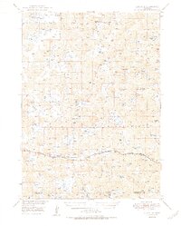
1950 Map of Lakeside
USGS Topo · Published 1950About this map
Lakeside serves as the primary rail hub in this Nebraska Sandhills landscape, situated along the Chicago Burlington and Quincy railroad line. The settlement pattern is defined by large ranching operations scattered across the dunes, including the Joy Ranch, Star Ranch, and Kieken Ranch. These family-named landmarks are punctuated by a high density of small, often alkaline basins such as White Lake, Snow Lake, and Hancock Lake, reflecting the unique hydrology of the region.
Find a feature on this map
52 named features on this map. Tap any name to fly to it.
Don’t see what you’re looking for? This feature index may not catch every label — zoom into the map to look around manually.
Map Details
Editions of this 1950 Lakeside Map
2 editions found

Other maps of this area

1896 · Browns Creek
USGS Topo · 1:125,000

1899 · Browns Creek
USGS Topo · 1:125,000

1948 · Bingham
USGS Topo · 1:62,500

1948 · Antioch
USGS Topo · 1:62,500

1948 · Lakeside
USGS Topo · 1:62,500

1948 · Twin Lakes
USGS Topo · 1:62,500

1948 · Spade Ranch
USGS Topo · 1:62,500

1949 · Mumper
USGS Topo · 1:62,500

1949 · Antioch
USGS Topo · 1:62,500

1950 · Twin Lakes
USGS Topo · 1:62,500