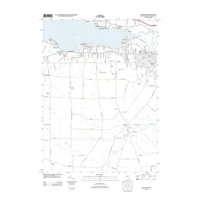
2013 Map of Lakewood
USGS Topo · Published 2013About this map
Chautauqua Lake dominates the northern landscape, its southern shores lined with a dense network of residential developments and summer communities including Lakewood, Celoron, and Maple Point. The transition from the lakefront to the agricultural interior is marked by numerous family-named landmarks and cemeteries, suggesting a deep-rooted lineage of land ownership. To the south, the village of Busti serves as a local hub near Stillwater Creek, surrounded by rural sites such as Knapp Cem and Bush Cem. This area reflects the mid-century evolution of the Chautauqua region, where traditional farming landscapes intersect with suburban expansion and recreational facilities like the Ridgeview Airport and the Maplehurst Golf Course. The map traces the winding paths of Hatch Creek and the Chadakoin River as they drain the upland plateaus toward the lake.
Find a feature on this map
172 named features on this map. Tap any name to fly to it.
Don’t see what you’re looking for? This feature index may not catch every label — zoom into the map to look around manually.
Map Details
Editions of this 2013 Lakewood Map
This is the sole edition of this map. No revisions or reprints were ever made.
Other maps of this area

1904 · Chautaqua
USGS Topo · 1:62,500

1905 · Jamestown
USGS Topo · 1:62,500

1906 · Warren
USGS Topo · 1:62,500

1907 · Warren
USGS Topo · 1:62,500

1908 · Warren
USGS Topo · 1:62,500

1926 · Youngsville
USGS Topo · 1:62,500

1929 · Youngsville
USGS Topo · 1:62,500

1941 · Chautauqua
USGS Topo · 1:62,500

1942 · Jamestown
USGS Topo · 1:62,500

1943 · Youngsville
USGS Topo · 1:62,500