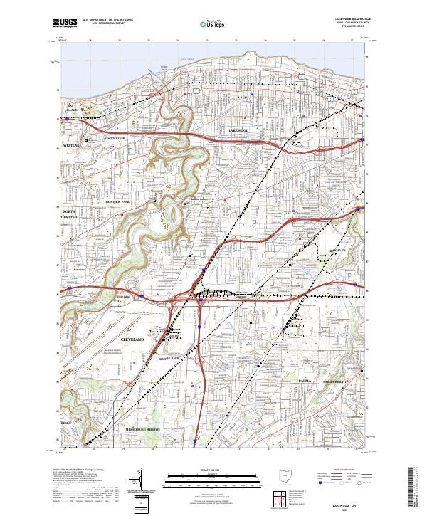
2023 Map of Lakewood
USGS Topo · Published 2023About this map
The southern shore of Lake Erie meets a dense network of suburbs in this detailed look at Cuyahoga County's western reaches. The Rocky River carves a deep valley through the landscape, separating Rocky River and Lakewood from the western expansion into Bay Village and Westlake. Historically significant corners of the community are evident at Kamms Corner and Short Line Junction, reflecting the area's development around transportation hubs. Genealogists will find a high density of burial grounds throughout the quadrangle, including Saint Patricks Cem, Holy Cross Cem, and the Alger Cem. To the south, the massive footprint of the Cleveland-Hopkins International Airport sits adjacent to Brook Park, while the headwaters of Abram Creek and the wetland environment around Lake Abram offer a contrast to the surrounding residential and industrial grids.
Find a feature on this map
51 named features on this map. Tap any name to fly to it.
Don’t see what you’re looking for? This feature index may not catch every label — zoom into the map to look around manually.
Map Details
Editions of this 2023 Lakewood Map
This is the sole edition of this map. No revisions or reprints were ever made.
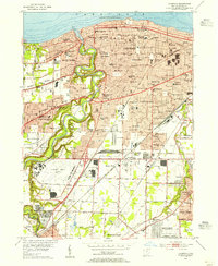
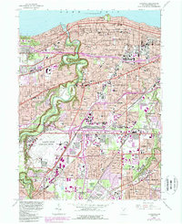
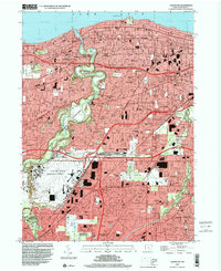
Historical Maps of Parma Through Time
4 maps found