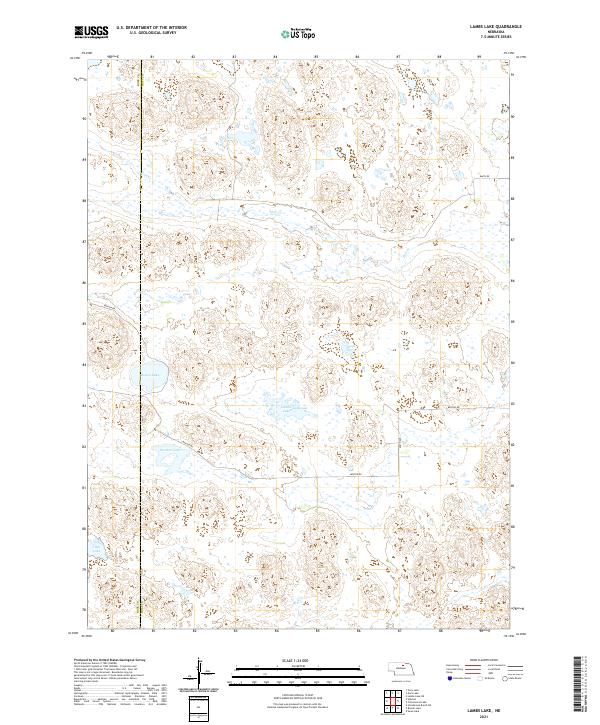
2021 Map of Lambs Lake
USGS Topo · Published 2021About this map
The boundary between Rock County and Holt County divides this Nebraska landscape, characterized by the intricate hydrography of the eastern Sandhills. Central to the area is Lambs Lake, which sits in a cluster of seasonal and permanent wetlands along with Overton Lake and Brown Lake. The terrain is defined by undulating sand dunes that have shaped the winding paths of the limited local road network, such as Benton Rd. To the north, the intermittent drainage of Holt Cr weaves through the topography, illustrating the subtle water systems that sustain this rangeland. The map provides a clear look at the Public Land Survey System grid, including corners of t28n r17w, t27n r16w, and surrounding townships, which remains the primary reference for land ownership and cattle ranching operations in this portion of the state.
Find a feature on this map
14 named features on this map. Tap any name to fly to it.
Don’t see what you’re looking for? This feature index may not catch every label — zoom into the map to look around manually.
Map Details
Editions of this 2021 Lambs Lake Map
This is the sole edition of this map. No revisions or reprints were ever made.
Other maps of this area

1955 · O'Neill
USGS Topo · 1:250,000

1959 · O'Neill
USGS Topo · 1:250,000

1969 · O'Neill
USGS Topo · 1:250,000

1981 · Swan Lake
USGS Topo · 1:24,000

1981 · Bruner Lake
USGS Topo · 1:24,000

1981 · Stonehouse Ranch NE
USGS Topo · 1:24,000
1982 · Cottonwood Lake
USGS Topo · 1:24,000

1982 · Sybrant
USGS Topo · 1:24,000

1982 · Dora Lake
USGS Topo · 1:24,000
1982 · Pony Lake
USGS Topo · 1:24,000