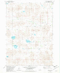
1982 Map of Lambs Lake
USGS Topo · Published 1982About this map
Holt Creek meanders through this landscape on the border of Rock and Holt counties, defining a region where water management is central to the land's utility. The presence of numerous Flowing Wells and specific named wells suggests a reliance on artesian water sources to support the small settlements of Brown and Tonawanda. Large, irregularly shaped water bodies like Lambs Lake, Brown Lake, and Overton Lake dominate the central and southern portions of the sheet, providing a stark contrast to the surrounding terrain. These lakes, along with smaller features like Frazier Lake and Clear Lake, illustrate the complex hydrology of the Nebraska Sandhills. The network of light-duty roads and benchmarks, such as BR 2312, indicates a surveyed but sparsely populated ranching or agricultural environment where natural landmarks and water access determine the placement of homesteads.
Find a feature on this map
14 named features on this map. Tap any name to fly to it.
Don’t see what you’re looking for? This feature index may not catch every label — zoom into the map to look around manually.
Map Details
Editions of this 1982 Lambs Lake Map
This is the sole edition of this map. No revisions or reprints were ever made.
Other maps of this area

1955 · O'Neill
USGS Topo · 1:250,000

1959 · O'Neill
USGS Topo · 1:250,000

1969 · O'Neill
USGS Topo · 1:250,000

1981 · Swan Lake
USGS Topo · 1:24,000

1981 · Bruner Lake
USGS Topo · 1:24,000

1981 · Stonehouse Ranch NE
USGS Topo · 1:24,000
1982 · Cottonwood Lake
USGS Topo · 1:24,000

1982 · Sybrant
USGS Topo · 1:24,000

1982 · Dora Lake
USGS Topo · 1:24,000
1982 · Pony Lake
USGS Topo · 1:24,000