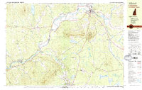
1982 Map of Lancaster
USGS Topo · Published 1983About this map
The Connecticut River serves as the winding border between New Hampshire and Vermont in this study of the upper valley. On the eastern banks, Lancaster stands as a primary hub, while the Vermont side is anchored by Lunenburg and the smaller settlement of South Lunenburg. This 1980s landscape shows the transition from industrial reliance on the Maine Central Railroad and Boston and Maine Railroad toward recreational use, centered around Weeks State Park and Prospect Mtn. For genealogists, the map is particularly detailed regarding burial grounds, marking sites like Riverside Cem near the river and Baptist Hill Cem further west. Notable infrastructure includes the White Mountains Regional High Sch and a preserved Covered Bridge crossing the river, documenting the essential connections between these riverfront communities.
Find a feature on this map
85 named features on this map. Tap any name to fly to it.
Don’t see what you’re looking for? This feature index may not catch every label — zoom into the map to look around manually.
Map Details
Editions of this 1982 Lancaster Map
2 editions found
Other maps of this area

1893 · Mt. Washington
USGS Topo · 1:62,500

1896 · Mt. Washington
USGS Topo · 1:62,500

1900 · Whitefield
USGS Topo · 1:62,500

1920 · Guildhall
USGS Topo · 1:62,500

1930 · Percy
USGS Topo · 1:62,500

1931 · Guildhall
USGS Topo · 1:48,000

1931 · Littleton
USGS Topo · 1:62,500

1932 · Littleton
USGS Topo · 1:48,000

1933 · Guildhall
USGS Topo · 1:48,000

1934 · Percy
USGS Topo · 1:62,500