2022 Map of Lane
USGS Topo · Published 2022About this map
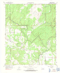
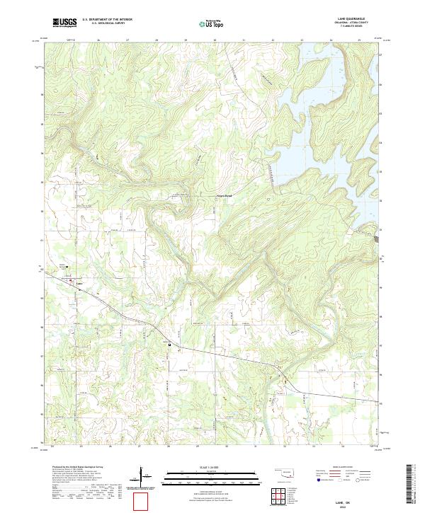
Muddy Boggy Creek and its many tributaries, including Potapo Creek and McGee Creek, define the intricate drainage patterns of this Atoka County landscape. The settlement of Lane serves as a primary hub, situated near the junction of Iron Stob Rd and Old State Hwy 3. Local history is anchored by sites such as Double Springs Cem and Butler Cem, while the northern terrain reveals distinct landform features like Negro Bend and the drainage of Wilson Hollow. The map also documents contemporary agricultural and commercial activity at the Yates Cattle Camp and labels numerous local routes including Bird Dog Rd and Rodeo Dr. This survey captures a moment of modern land management where established rural homesteads meet preserved water resources and traditional cattle operations in southeastern Oklahoma.
Find a feature on this map
66 named features on this map. Tap any name to fly to it.
Don’t see what you’re looking for? This feature index may not catch every label — zoom into the map to look around manually.
Map Details
Editions of this 2022 Lane Map
This is the sole edition of this map. No revisions or reprints were ever made.