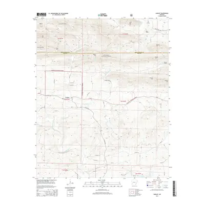
2014 Map of Langley
USGS Topo · Published 2014About this map
Langley sits at the junction of Ar-84 and AR 369 Hwy N in Pike County, serving as a gateway to the southern reaches of the Ouachita National Forest. The landscape is defined by the sharp transition from the Cossatot Mountains in the northwest to the complex drainage basins of the Little Missouri River and the S Fork Caddo River. Notable peaks like Fancy Hill Mtn and Pryor Mtn overlook a network of rural roads such as McFarlin Rd and W Oldam Rd that connect isolated settlements and family landholdings. To the northeast, the Fancy Hill Cem remains a significant genealogical landmark near Back Valley. The southeastern corner of the quadrangle touches the northern extent of Lake Greeson, where the river systems begin to consolidate. This 2014 survey documents the enduring rural character of the region, where topographical gaps like Redland Gap and valleys like Brooks Valley have historically dictated the placement of local thoroughfares.
Find a feature on this map
53 named features on this map. Tap any name to fly to it.
Don’t see what you’re looking for? This feature index may not catch every label — zoom into the map to look around manually.
Map Details
Editions of this 2014 Langley Map
This is the sole edition of this map. No revisions or reprints were ever made.
Other maps of this area

1906 · Caddo Gap
USGS Topo · 1:125,000

1936 · Athens
USGS Topo · 1:48,000

1936 · Glenwood
USGS Topo · 1:48,000

1942 · Glenwood
USGS Topo · 1:62,500

1942 · Athens
USGS Topo · 1:62,500

1949 · Glenwood
USGS Topo · 1:62,500

1955 · Little Rock
USGS Topo · 1:250,000

1956 · Little Rock
USGS Topo · 1:250,000

1960 · Little Rock
USGS Topo · 1:250,000

1964 · Little Rock
USGS Topo · 1:250,000