2022 Map of Lapel
USGS Topo · Published 2022About this map
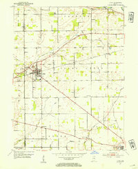
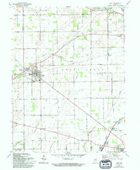
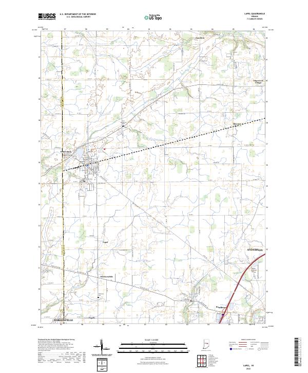
The town of Lapel sits at the center of this 2022 survey, surrounded by a complex network of agricultural drainage and family landmarks that define the southern Madison County landscape. This modern study tracks the evolution of the area’s historic small towns, from the compact grid of Fishersburg on the banks of Stony Cr to the more developed corridors of Pendleton and Ingalls to the south. The rural sections are heavily marked by significant local history sites, including the Old Woodward Cem, Brookside Cem, and Nicholson Cem, providing precise locations for genealogical research and land use studies.
Find a feature on this map
101 named features on this map. Tap any name to fly to it.
Don’t see what you’re looking for? This feature index may not catch every label — zoom into the map to look around manually.
Map Details
Editions of this 2022 Lapel Map
This is the sole edition of this map. No revisions or reprints were ever made.