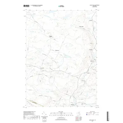
2019 Map of Lassellsville
USGS Topo · Published 2019About this map
Lassellsville and its neighboring hamlets define this rural expanse in the southwestern Adirondack foothills. The map captures a landscape of small, distributed settlements like Garoga, Rockwood, and Scotchbrush, where the local economy was historically shaped by the numerous watercourses winding through the hills. Water remains a central feature, from the Fort Plain Reservoir to the complex network of creeks including Caroga Creek, Sprite Cr, and Zimmerman Cr. For genealogists, the map is particularly valuable for its documentation of numerous small burial grounds, including the Dillaborough Cem, Fical Cem, and Christman Cem. The southern boundary of the quadrangle marks the transition between Fulton Co and Montgomery Co, providing a clear view of the regional topography and the road networks that connect these historic upstate communities.
Find a feature on this map
73 named features on this map. Tap any name to fly to it.
Don’t see what you’re looking for? This feature index may not catch every label — zoom into the map to look around manually.
Map Details
Editions of this 2019 Lassellsville Map
This is the sole edition of this map. No revisions or reprints were ever made.
Other maps of this area

1896 · Fonda
USGS Topo · 1:62,500

1898 · Fonda
USGS Topo · 1:62,500

1898 · Canajoharie
USGS Topo · 1:62,500

1900 · Canajoharie
USGS Topo · 1:62,500

1901 · Lassellsville
USGS Topo · 1:62,500

1902 · Canajoharie
USGS Topo · 1:62,500

1902 · Fonda
USGS Topo · 1:62,500

1903 · Gloversville
USGS Topo · 1:62,500

1903 · Lassellsville
USGS Topo · 1:62,500

1943 · Gloversville
USGS Topo · 1:62,500