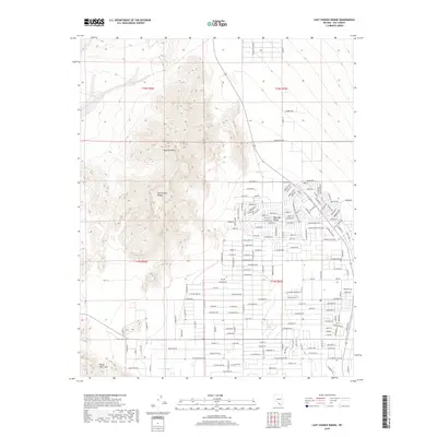
2018 Map of Last Chance Range
USGS Topo · Published 2018About this map
Last Chance Range and the Devils Hole Hills dominate the topography of this desert landscape, where the high-relief peaks of the Mojave Desert transition into the developing suburban grid of the Pahrump Valley. This survey captures the encroachment of residential infrastructure into the arid basin, marked by an extensive network of named streets like Roadrunner Rd and W Bluebird Ave that overlay the traditional ranching lands of the region. The map provides specific geographic evidence of local land use, notably the Blosser Ranch and the agricultural legacy preserved in names like W Harris Farm Rd. The contrast between the rigid, surveyed township boundaries and the irregular, ancient landforms illustrates the ongoing human effort to organize and inhabit this portion of the Nevada desert during the early twenty-first century.
Find a feature on this map
108 named features on this map. Tap any name to fly to it.
Don’t see what you’re looking for? This feature index may not catch every label — zoom into the map to look around manually.
Map Details
Editions of this 2018 Last Chance Range Map
This is the sole edition of this map. No revisions or reprints were ever made.
Other maps of this area

1907 · Las Vegas
USGS Topo · 1:250,000

1908 · Furnace Creek
USGS Topo · 1:250,000

1908 · Las Vegas
USGS Topo · 1:250,000

1910 · Furnace Creek
USGS Topo · 1:250,000

1948 · Death Valley
USGS Topo · 1:250,000

1954 · Las Vegas
USGS Topo · 1:250,000

1954 · Death Valley
USGS Topo · 1:250,000

1956 · Death Valley
USGS Topo · 1:250,000

1957 · Las Vegas
USGS Topo · 1:250,000

1957 · Death Valley
USGS Topo · 1:250,000