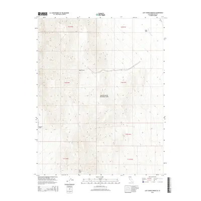
2015 Map of Last Chance Range SE
USGS Topo · Published 2015About this map
Death Valley National Park encompasses the vast majority of this 2015 topographic study, where the arid transition between the Death Valley basin and the higher reaches of the Mojave Desert is meticulously documented. The landscape is defined by extreme relief and the presence of seasonal drainage systems, most notably the Death Valley Wash which cuts through the northeastern corner of the quadrangle. In the lower reaches of the map, the terrain is shaped by the Last Chance Range, including the steep-walled Dedeckera Canyon. This survey captures a moment in the modern management of these protected lands, where historical travel routes like Big Pine Rd continue to provide the primary access through the high desert wilderness. The map provides essential detail for understanding the hydrological patterns of one of the most arid environments in North America.
Find a feature on this map
11 named features on this map. Tap any name to fly to it.
Don’t see what you’re looking for? This feature index may not catch every label — zoom into the map to look around manually.
Map Details
Editions of this 2015 Last Chance Range SE Map
This is the sole edition of this map. No revisions or reprints were ever made.
Other maps of this area

1908 · Lida
USGS Topo · 1:250,000

1908 · Ballarat
USGS Topo · 1:250,000

1913 · Lida
USGS Topo · 1:250,000

1913 · Ballarat
USGS Topo · 1:250,000

1948 · Death Valley
USGS Topo · 1:250,000

1954 · Death Valley
USGS Topo · 1:250,000

1954 · Goldfield
USGS Topo · 1:250,000

1955 · Goldfield
USGS Topo · 1:250,000

1956 · Death Valley
USGS Topo · 1:250,000

1957 · Death Valley
USGS Topo · 1:250,000