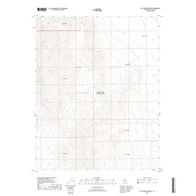
2018 Map of Last Chance Range SE
USGS Topo · Published 2018About this map
The Last Chance Range dominates the western half of this 2018 survey, characterized by dramatic elevation changes within Death Valley National Park. This arid landscape is defined by the sharp descent from the high ridges into the northern reaches of the Mojave Desert. Along the western edge, Dedeckera Canyon cuts through the terrain, providing a natural conduit for drainage toward the lower basins. The eastern portion of the map transitions into the wide, alluvial expanse of Death Valley, where Death Valley Wash serves as a primary drainage corridor. The surveying labels indicate the complex public land management boundaries that overlay this wilderness, marking sections across several townships in Inyo County. This sheet captures a portion of the desert where geological features and desert hydrology dictate the few navigable paths through the high-relief terrain.
Find a feature on this map
12 named features on this map. Tap any name to fly to it.
Don’t see what you’re looking for? This feature index may not catch every label — zoom into the map to look around manually.
Map Details
Editions of this 2018 Last Chance Range SE Map
This is the sole edition of this map. No revisions or reprints were ever made.
Other maps of this area

1908 · Lida
USGS Topo · 1:250,000

1908 · Ballarat
USGS Topo · 1:250,000

1913 · Lida
USGS Topo · 1:250,000

1913 · Ballarat
USGS Topo · 1:250,000

1948 · Death Valley
USGS Topo · 1:250,000

1954 · Death Valley
USGS Topo · 1:250,000

1954 · Goldfield
USGS Topo · 1:250,000

1955 · Goldfield
USGS Topo · 1:250,000

1956 · Death Valley
USGS Topo · 1:250,000

1957 · Death Valley
USGS Topo · 1:250,000