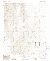
1987 Map of Last Chance Range SE
USGS Topo · Published 1987About this map
Last Chance Range dominates this 1980s landscape, illustrating the severe desert topography within the northern reaches of the Death Valley National Monument. The map detail captures a remote environment where drainage patterns like Death Valley Wash and the narrow passage of Dedeckera Canyon define the navigable routes through the high ridges. Human activity is sparse, marked only by isolated four-wheel-drive tracks and a lone Prospect located near the center of the sheet. This provisional survey provides a precise look at the transition between the steep peaks of the range and the lower valley floor, offering researchers a view of this protected wilderness before the area's designation was changed from a monument to a national park.
Find a feature on this map
7 named features on this map. Tap any name to fly to it.
Don’t see what you’re looking for? This feature index may not catch every label — zoom into the map to look around manually.
Map Details
Editions of this 1987 Last Chance Range SE Map
This is the sole edition of this map. No revisions or reprints were ever made.
Other maps of this area

1908 · Lida
USGS Topo · 1:250,000

1908 · Ballarat
USGS Topo · 1:250,000

1913 · Lida
USGS Topo · 1:250,000

1913 · Ballarat
USGS Topo · 1:250,000

1948 · Death Valley
USGS Topo · 1:250,000

1954 · Death Valley
USGS Topo · 1:250,000

1954 · Goldfield
USGS Topo · 1:250,000

1955 · Goldfield
USGS Topo · 1:250,000

1956 · Death Valley
USGS Topo · 1:250,000

1957 · Death Valley
USGS Topo · 1:250,000