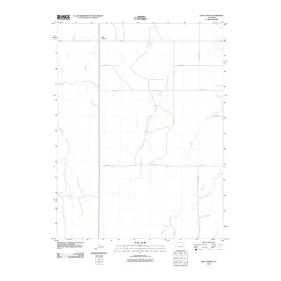
2010 Map of Last Chance
USGS Topo · Published 2010About this map
Last Chance sits at a high-plains crossroads in Washington County, where the sprawling grid of the Colorado eastern plains meets the subtle drainage of the High Plains. The landscape is defined by the ephemeral winding of the West Fork Plumb Bush Creek and East Fork Plumb Bush Creek, which cut shallow north-south paths through the open country. This 2010 survey illustrates the rigid geometric order of local transport, dominated by a numbered and lettered grid including County Rd-11, County Rd-10, and County Road K. To the southeast, Vega Creek introduces a diagonal break in the terrain, reflecting the natural contours that dictate local water management and ranching boundaries in this sparsely populated region of the state.
Find a feature on this map
12 named features on this map. Tap any name to fly to it.
Don’t see what you’re looking for? This feature index may not catch every label — zoom into the map to look around manually.
Map Details
Editions of this 2010 Last Chance Map
This is the sole edition of this map. No revisions or reprints were ever made.
Other maps of this area

1954 · Limon
USGS Topo · 1:250,000

1957 · Limon
USGS Topo · 1:250,000

1958 · Limon
USGS Topo · 1:250,000

1973 · Dry Gulch
USGS Topo · 1:24,000

1973 · Last Chance SW
USGS Topo · 1:24,000

1973 · Last Chance NW
USGS Topo · 1:24,000

1973 · Lusto Springs
USGS Topo · 1:24,000

1973 · Lindon SW
USGS Topo · 1:24,000

1973 · Lindon
USGS Topo · 1:24,000

1973 · Last Chance
USGS Topo · 1:24,000