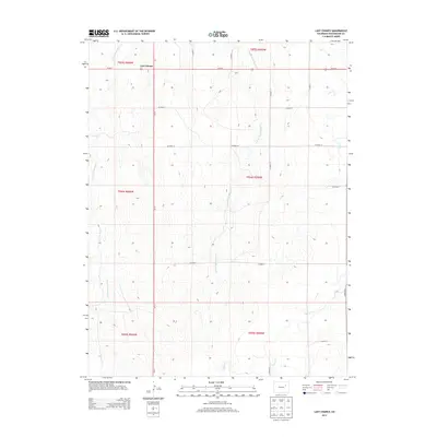
2013 Map of Last Chance
USGS Topo · Published 2013About this map
Last Chance stands at the intersection of Us-36 E and Co-71, serving as a vital point of navigation on the eastern plains of Washington County. This landscape is defined by the ephemeral drainage patterns of the W Fork Plum Bush Cr and E Fork Plum Bush Cr, which create subtle variations in the local topography. The map reveals the rigid grid of the Public Land Survey System, with county roads such as Co Road 11 and Co Road 7 following section lines across the high plains. The intermittent path of Vega Cr cuts through the eastern sections, illustrating the water-dependent nature of life and ranching in this semi-arid region. The layout of these transit corridors and natural draws provides a clear view of how land was partitioned and managed in the early 21st century.
Find a feature on this map
22 named features on this map. Tap any name to fly to it.
Don’t see what you’re looking for? This feature index may not catch every label — zoom into the map to look around manually.
Map Details
Editions of this 2013 Last Chance Map
This is the sole edition of this map. No revisions or reprints were ever made.
Other maps of this area

1954 · Limon
USGS Topo · 1:250,000

1957 · Limon
USGS Topo · 1:250,000

1958 · Limon
USGS Topo · 1:250,000

1973 · Dry Gulch
USGS Topo · 1:24,000

1973 · Last Chance SW
USGS Topo · 1:24,000

1973 · Last Chance NW
USGS Topo · 1:24,000

1973 · Lusto Springs
USGS Topo · 1:24,000

1973 · Lindon SW
USGS Topo · 1:24,000

1973 · Lindon
USGS Topo · 1:24,000

1973 · Last Chance
USGS Topo · 1:24,000