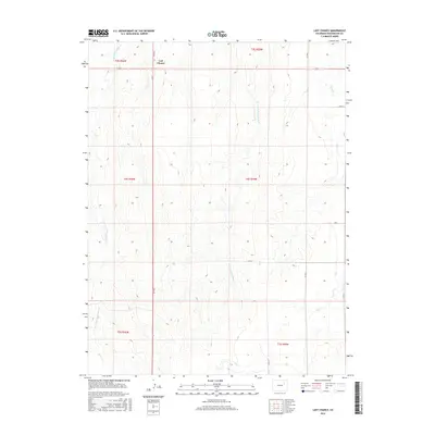
2016 Map of Last Chance
USGS Topo · Published 2016About this map
Last Chance is the central point of interest in this high-plains landscape, situated at a crossroads where the local road network converges. The geography is defined by a series of north-south drainage patterns, most notably the seasonal waterways of East Fork Plumb Bush Cr and West Fork Plumb Bush Cr. To the southeast, the terrain transitions toward the valley of Vega Cr. This map illustrates a characteristic Colorado prairie settlement pattern, where small hubs like Last Chance developed to serve the agricultural community. The grid of rural routes, including Co RD G and Co RD 7, follows the Public Land Survey System lines, reflecting the structured organization of the eastern plains. The drainage of W Fork Plumb Bush Cr in the northwest corner further emphasizes the subtle but vital topography of this semi-arid region.
Find a feature on this map
18 named features on this map. Tap any name to fly to it.
Don’t see what you’re looking for? This feature index may not catch every label — zoom into the map to look around manually.
Map Details
Editions of this 2016 Last Chance Map
This is the sole edition of this map. No revisions or reprints were ever made.
Other maps of this area

1954 · Limon
USGS Topo · 1:250,000

1957 · Limon
USGS Topo · 1:250,000

1958 · Limon
USGS Topo · 1:250,000

1973 · Dry Gulch
USGS Topo · 1:24,000

1973 · Last Chance SW
USGS Topo · 1:24,000

1973 · Last Chance NW
USGS Topo · 1:24,000

1973 · Lusto Springs
USGS Topo · 1:24,000

1973 · Lindon SW
USGS Topo · 1:24,000

1973 · Lindon
USGS Topo · 1:24,000

1973 · Last Chance
USGS Topo · 1:24,000