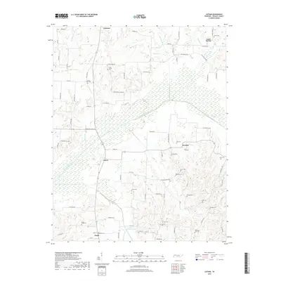
2019 Map of Latham
USGS Topo · Published 2019About this map
Latham and the surrounding rural communities of Dukedom and Austin Springs define this corner of Weakley County, where the landscape is deeply etched by the North Fork Obion River and its numerous tributaries. This area is characterized by its significant number of family and community burial grounds, which serve as a foundational record for local genealogists. From the Hatlers Chapel Cem in the south to the Murrell Cem in the northeast, these sites are dispersed among a network of country roads like Boydsville Rd and Austin Springs Rd.
Find a feature on this map
85 named features on this map. Tap any name to fly to it.
Don’t see what you’re looking for? This feature index may not catch every label — zoom into the map to look around manually.
Map Details
Editions of this 2019 Latham Map
This is the sole edition of this map. No revisions or reprints were ever made.
Other maps of this area

1950 · Martin
USGS Topo · 1:24,000

1952 · Dresden
USGS Topo · 1:24,000

1952 · Cuba
USGS Topo · 1:24,000

1952 · Water Valley
USGS Topo · 1:24,000

1952 · Mayfield
USGS Topo · 1:62,500

1952 · Water Valley
USGS Topo · 1:62,500
1952 · Lynnville
USGS Topo · 1:24,000

1956 · Mc Connell
USGS Topo · 1:24,000

1956 · Latham
USGS Topo · 1:24,000
1956 · Palmersville
USGS Topo · 1:24,000