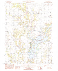
1985 Map of Latona
USGS Topo · Published 1985About this map
Latona and Winterrowd anchor this Jasper County landscape in the mid-1980s, where the rural character is defined by a extensive system of waterways and conservation lands. The map illustrates a significant industrial and ecological footprint, centered on the large Newton Lake and its associated Power Plant. Adjoining the lake, the Newton Lake State Fish and Wildlife Area provides a contrast to the industrial utilities like the nearby Slurry Pond.
Find a feature on this map
25 named features on this map. Tap any name to fly to it.
Don’t see what you’re looking for? This feature index may not catch every label — zoom into the map to look around manually.
Map Details
Editions of this 1985 Latona Map
This is the sole edition of this map. No revisions or reprints were ever made.
Other maps of this area

1940 · Greenup
USGS Topo · 1:62,500

1941 · Newton
USGS Topo · 1:62,500

1943 · Greenup
USGS Topo · 1:62,500

1943 · Newton
USGS Topo · 1:62,500

1953 · Teutopolis
USGS Topo · 1:62,500

1953 · Sailor Springs
USGS Topo · 1:62,500

1958 · Decatur
USGS Topo · 1:250,000

1958 · Belleville
USGS Topo · 1:250,000

1961 · Decatur
USGS Topo · 1:250,000

1962 · Belleville
USGS Topo · 1:250,000