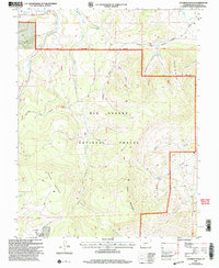
2001 Map of Laughlin Gulch
USGS Topo · Published 2005About this map
The Rio Grande National Forest dominates this section of south-central Colorado, as documented in this 2001 revision by the USDA Forest Service. The high-altitude landscape is defined by its seasonal grazing and water infrastructure, most notably the Laughlin Stock Driveway which cuts across the terrain north of Spruce Mountain. This historical path reflects the region's long-standing sheep and cattle ranching traditions, providing a designated corridor for moving livestock between valley floors and mountain pastures.
Find a feature on this map
22 named features on this map. Tap any name to fly to it.
Don’t see what you’re looking for? This feature index may not catch every label — zoom into the map to look around manually.
Map Details
Editions of this 2001 Laughlin Gulch Map
This is the sole edition of this map. No revisions or reprints were ever made.
Other maps of this area

1915 · Del Norte
USGS Topo · 1:125,000

1917 · Del Norte
USGS Topo · 1:125,000

1945 · Durango
USGS Topo · 1:250,000

1953 · Durango
USGS Topo · 1:250,000

1954 · Durango
USGS Topo · 1:250,000

1956 · Montrose
USGS Topo · 1:250,000

1959 · Montrose
USGS Topo · 1:250,000

1960 · Montrose
USGS Topo · 1:250,000

1961 · Durango
USGS Topo · 1:250,000

1963 · Durango
USGS Topo · 1:250,000