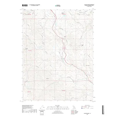
2018 Map of Laughlin Range
USGS Topo · Published 2018About this map
Laughlin Range and the high ridges south of Willits define this Mendocino County terrain, where the headwaters of numerous creeks begin their descent through the coastal mountains. The landscape is characterized by a complex network of canyons and peaks, including Eagle Peak and the aptly named Impassable Rocks. Water management and natural catchments are central to the area's geography, evidenced by Morris Dam and several upland water bodies like Walker Lake, Mud Lake, and Leonard Lake.
Find a feature on this map
54 named features on this map. Tap any name to fly to it.
Don’t see what you’re looking for? This feature index may not catch every label — zoom into the map to look around manually.
Map Details
Editions of this 2018 Laughlin Range Map
This is the sole edition of this map. No revisions or reprints were ever made.
Other maps of this area

1920 · Ukiah
USGS Topo · 1:62,500

1922 · Willits
USGS Topo · 1:62,500

1942 · Willits
USGS Topo · 1:62,500

1943 · Pomo
USGS Topo · 1:62,500

1943 · Boonville
USGS Topo · 1:62,500

1944 · Ukiah
USGS Topo · 1:62,500

1944 · Willits
USGS Topo · 1:62,500

1957 · Ukiah
USGS Topo · 1:250,000

1958 · Ukiah
USGS Topo · 1:24,000
1958 · Ukiah
USGS Topo · 1:62,500