2023 Map of Laurel
USGS Topo · Published 2023About this map
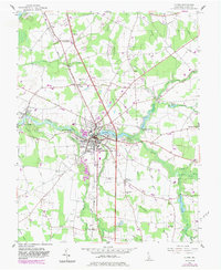
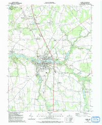
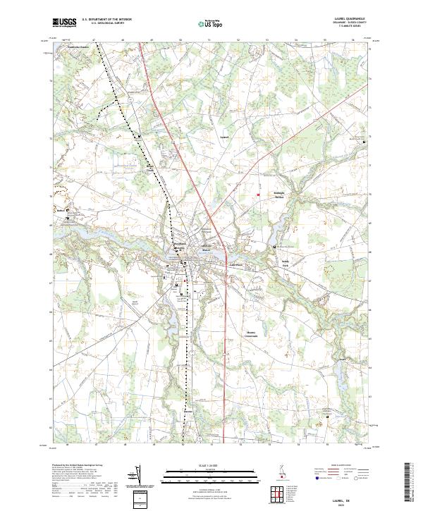
Broad Creek and its complex network of managed drainage ways define the landscape around Laurel, where the Bulkhead-Shoal Channel and Records Pond meet the town center. This area in Sussex County shows a dense concentration of religious and genealogical sites, particularly the Old Christ Church Cem and the Sailors Bethel United Methodist Church Cem near the riverfront. The map documents the low-lying terrain characterized by numerous agricultural ditches like the Black Savannah Ditch and Bacon and Kenney Ditch, which support the region's long-standing land-use patterns. From the riverside community of Bethel to the crossroads at Bacons and Lowe, the geography is a mix of small residential clusters, active aviation at Laurel Airport, and established cemeteries that provide a clear record of local family history.
Find a feature on this map
178 named features on this map. Tap any name to fly to it.
Don’t see what you’re looking for? This feature index may not catch every label — zoom into the map to look around manually.
Map Details
Editions of this 2023 Laurel Map
This is the sole edition of this map. No revisions or reprints were ever made.