2022 Map of Lavon
USGS Topo · Published 2022About this map
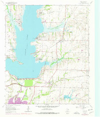
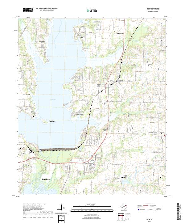
Lavon Lake dominates the central landscape of this Collin County survey, where residential expansion meets the historical rural footprint of the East Fork Trinity River valley. The modern settlements of Lavon, Nevada, and Copeville are clearly defined, showing the density of contemporary development alongside long-standing local landmarks. A notable concentration of historical burial sites, including Backbone Cem, Shiloh Cem, and the Old South Church Cem, provides a detailed record of the area's early families. The map also captures specialized transport and recreation nodes such as the Lazy Dog Ranch Airpark and Kudlacek Field. Along the shoreline, named residential enclaves like Lavon Beach Estates and Deep Water Point Estates illustrate the shift toward lakeside living, while the surrounding creeks, including Ticky Cr and Bear Cr, trace the natural drainage patterns of the north Texas blackland prairie.
Find a feature on this map
159 named features on this map. Tap any name to fly to it.
Don’t see what you’re looking for? This feature index may not catch every label — zoom into the map to look around manually.
Map Details
Editions of this 2022 Lavon Map
This is the sole edition of this map. No revisions or reprints were ever made.