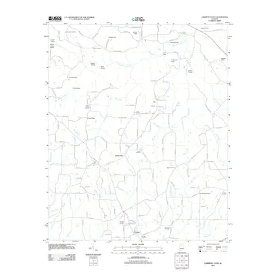
2011 Map of Lawrence Cove
USGS Topo · Published 2011About this map
Fairview and County Line anchor the southern reaches of this landscape, where the headwaters of numerous creeks begin their descent through the plateaus of Cullman County. The map reveals a high density of rural burial grounds and places of worship, including Harmony Cemetery, Canaan Cemetery, and Daniels Chapel. Water defines the local geography, with the West Fork Cotaco Creek carving through the northern terrain, supplemented by landmarks like Welcome Falls and Crow Bridge. The distribution of family-named features such as Martin Hollow, Bates Hollow, and Persimmon Knob provides a detailed look at the local topography and historical landholdings. This survey captures a community deeply connected to its small waterways, from Mud Creek in the east to Eightmile Creek in the west.
Find a feature on this map
154 named features on this map. Tap any name to fly to it.
Don’t see what you’re looking for? This feature index may not catch every label — zoom into the map to look around manually.
Map Details
Editions of this 2011 Lawrence Cove Map
This is the sole edition of this map. No revisions or reprints were ever made.
Other maps of this area

1888 · Cullman
USGS Topo · 1:125,000

1892 · Cullman
USGS Topo · 1:125,000

1936 · Hulaco
USGS Topo · 1:24,000

1936 · Eva
USGS Topo · 1:24,000

1936 · Somerville
USGS Topo · 1:24,000

1936 · Lawrence Cove
USGS Topo · 1:24,000

1936 · Center Grove
USGS Topo · 1:24,000

1936 · Holly Pond
USGS Topo · 1:24,000
1936 · Newsome Sinks
USGS Topo · 1:24,000
1947 · Newsome Sinks
USGS Topo · 1:24,000