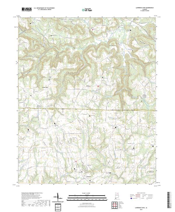
2024 Map of Lawrence Cove
USGS Topo · Published 2024About this map
The Tennessee Valley Divide cuts through this portion of northern Alabama, separating the varied drainage basins of the Lawrence Cove area. To the north, the landscape is defined by significant elevations like Self Mountain and Persimmon Knob, where numerous springs such as Martin Spring and Roan Spring feed the northward-flowing creeks. Below the divide, the terrain transitions into the agricultural lands surrounding the communities of Eva, Center Dale, and Fairview. The map is particularly notable for its dense concentration of historical burial sites, including the Old Enon Cem, Daniels Chapel Cem, and Etha Community Cem, which serve as vital markers for local family history and genealogy. The boundary between Morgan Co and Cullman Co runs east-to-west across the central portion of the sheet, dividing the rural settlements and farmsteads that have long characterized this highland region.
Find a feature on this map
165 named features on this map. Tap any name to fly to it.
Don’t see what you’re looking for? This feature index may not catch every label — zoom into the map to look around manually.
Map Details
Editions of this 2024 Lawrence Cove Map
This is the sole edition of this map. No revisions or reprints were ever made.
Other maps of this area

1888 · Cullman
USGS Topo · 1:125,000

1892 · Cullman
USGS Topo · 1:125,000

1936 · Hulaco
USGS Topo · 1:24,000

1936 · Eva
USGS Topo · 1:24,000

1936 · Somerville
USGS Topo · 1:24,000

1936 · Lawrence Cove
USGS Topo · 1:24,000

1936 · Center Grove
USGS Topo · 1:24,000

1936 · Holly Pond
USGS Topo · 1:24,000
1936 · Newsome Sinks
USGS Topo · 1:24,000
1947 · Newsome Sinks
USGS Topo · 1:24,000