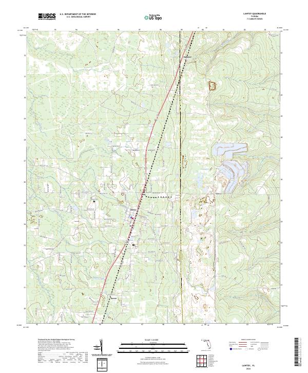
2024 Map of Lawtey
USGS Topo · Published 2024About this map
Lawtey serves as the primary hub of this North Florida landscape, positioned along the prominent north-south transit corridor that bisects the region. The town's local history is anchored by the Lawtey Cem, while smaller settlements such as Highland to the north and Saxton to the south mark the rural reaches of the county line between Bradford Co and Clay Co. The physical geography is defined by the Trail Ridge, a significant elevated landform that influences the local drainage patterns of several winding waterways. These include Alligator Creek, Olustee Creek, and Water Oak Creek, which weave through the low-lying terrain. The map details an extensive network of rural roads like Middleburg Rd and Jack Wilkerson Rd, illustrating the transition from concentrated village blocks to the expansive wooded and agricultural tracts that characterize this part of the Florida interior.
Find a feature on this map
53 named features on this map. Tap any name to fly to it.
Don’t see what you’re looking for? This feature index may not catch every label — zoom into the map to look around manually.
Map Details
Editions of this 2024 Lawtey Map
This is the sole edition of this map. No revisions or reprints were ever made.
Other maps of this area

1918 · Middleburg
USGS Topo · 1:62,500

1918 · Lawtey
USGS Topo · 1:62,500

1941 · Starke
USGS Topo · 1:62,500

1941 · Middleburg
USGS Topo · 1:62,500

1942 · Ates Creek
USGS Topo · 1:62,500

1948 · Starke
USGS Topo · 1:50,000

1948 · Jacksonville
USGS Topo · 1:250,000

1949 · Middleburg SW
USGS Topo · 1:24,000

1949 · Sampson
USGS Topo · 1:24,000

1949 · Fiftone
USGS Topo · 1:24,000