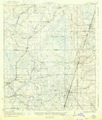
1918 Map of Lawtey
USGS Topo · Published 1942About this map
Lawtey and the surrounding piney lowlands of Northeast Florida appear here during the transition into the early twentieth century. The landscape is defined by the massive New River Swamp and the elevated Trail Ridge, which dictates the path of the Seaboard Air Line and Atlantic Coast Line railroads. The map reveals a dense network of early rural social centers, including numerous family-named and local schools such as Rose School, Futch School, and Vanderbilt School.
Find a feature on this map
62 named features on this map. Tap any name to fly to it.
Don’t see what you’re looking for? This feature index may not catch every label — zoom into the map to look around manually.
Map Details
Editions of this 1918 Lawtey Map
5 editions found
Other maps of this area

1917 · Cambon
USGS Topo · 1:62,500

1917 · Macclenny
USGS Topo · 1:62,500

1918 · Middleburg
USGS Topo · 1:62,500

1918 · Lawtey
USGS Topo · 1:62,500

1918 · Cambon
USGS Topo · 1:62,500

1918 · Macclenny
USGS Topo · 1:62,500

1941 · Starke
USGS Topo · 1:62,500

1941 · Middleburg
USGS Topo · 1:62,500

1942 · Ates Creek
USGS Topo · 1:62,500

1948 · Starke
USGS Topo · 1:50,000