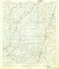
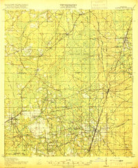
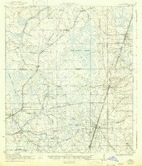
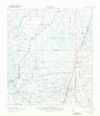
1918 Map of Lawtey
USGS Topo · Published 1939About this map
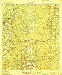
Trail Ridge and Clay Hill define the eastern rise of this North Florida landscape, providing a dramatic contrast to the low-lying New River Swamp that dominates the central terrain. Surveyed toward the end of the Great War, the map documents a region heavily influenced by the expansion of the Atlantic Coast Line and Seaboard Air Line railroads, which facilitated the development of towns like Lawtey and Raiford.
Find a feature on this map
59 named features on this map. Tap any name to fly to it.
Don’t see what you’re looking for? This feature index may not catch every label — zoom into the map to look around manually.
Map Details
Editions of this 1918 Lawtey Map
5 editions found
Other maps of this area

1917 · Cambon
USGS Topo · 1:62,500

1917 · Macclenny
USGS Topo · 1:62,500

1918 · Middleburg
USGS Topo · 1:62,500

1918 · Lawtey
USGS Topo · 1:62,500

1918 · Cambon
USGS Topo · 1:62,500
1918 · Macclenny
USGS Topo · 1:62,500

1941 · Starke
USGS Topo · 1:62,500

1941 · Middleburg
USGS Topo · 1:62,500

1942 · Ates Creek
USGS Topo · 1:62,500

1948 · Starke
USGS Topo · 1:50,000