2021 Map of Lead
USGS Topo · Published 2021About this map
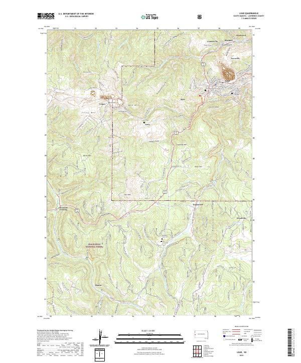
The gold-mining legacy of Lawrence County is etched into the landscape surrounding Lead and Deadwood, where the terrain is a complex network of gulches and summits. Deep canyons like Blacktail Gulch and Sawmill Gulch reflect the intensive resource extraction of the region, while the Black Hills National Forest encompasses the high ridges of Terry Peak and Bald Mtn. This map documents a modern view of historically significant locations such as Central City and Terraville, settlements that grew up around the early mineral strikes.
Find a feature on this map
152 named features on this map. Tap any name to fly to it.
Don’t see what you’re looking for? This feature index may not catch every label — zoom into the map to look around manually.
Map Details
Editions of this 2021 Lead Map
This is the sole edition of this map. No revisions or reprints were ever made.