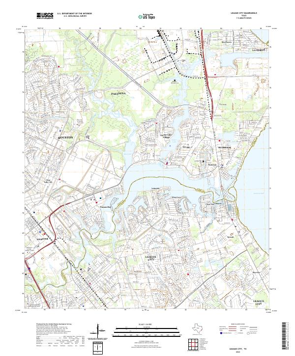
2022 Map of League City
USGS Topo · Published 2022About this map
Galveston Bay defines the eastern edge of this coastal landscape, where a dense network of suburban developments and bayous characterizes the region south of Pasadena and Houston. By the early 2020s, the area shows significant residential density in cities like League City, Webster, and Seabrook. The map captures the complex interaction of land and water, from the winding course of Armand Bayou and Taylor Lake to smaller tributaries like Cow Bayou and Robinson Bayou. Notable institutions such as the University of Houston - Clear Lake and College of the Mainland Learning Center North serve the local population. For genealogists and local historians, several burial sites are documented, including the Hammer-McFaddin Cem and Larrabee Cem, while transportation is anchored by the historic Old Galveston Rd and modern corridors like NASA Road 1.
Find a feature on this map
52 named features on this map. Tap any name to fly to it.
Don’t see what you’re looking for? This feature index may not catch every label — zoom into the map to look around manually.
Map Details
Editions of this 2022 League City Map
This is the sole edition of this map. No revisions or reprints were ever made.
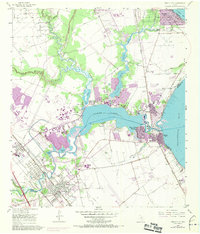
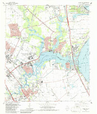
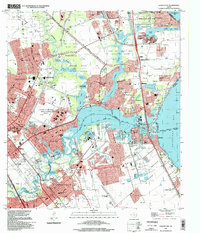
Historical Maps of Kemah Through Time
4 maps found