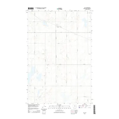
2014 Map of Leal
USGS Topo · Published 2014About this map
Leal serves as the central point of this North Dakota landscape, situated at the intersection of Railway St and 103rd Ave SE. The settlement's layout is defined by its historic rail-aligned orientation, distinct from the rigid north-south grid that organizes the surrounding agricultural terrain. A network of section roads, including ND-9, 20th St SE, and 106th Ave SE, delineates the prairie parcels and connects the small village to the broader region of Barnes County. The topography is characterized by numerous small water bodies and depressions typical of the regional glacial prairie pothole landscape, which have influenced the placement of local thoroughfares like 25th St SE and 101st Ave SE.
Find a feature on this map
16 named features on this map. Tap any name to fly to it.
Don’t see what you’re looking for? This feature index may not catch every label — zoom into the map to look around manually.
Map Details
Editions of this 2014 Leal Map
This is the sole edition of this map. No revisions or reprints were ever made.
Other maps of this area

1897 · Eckelson
USGS Topo · 1:125,000

1952 · New Rockford
USGS Topo · 1:250,000

1953 · Jamestown
USGS Topo · 1:250,000

1956 · New Rockford
USGS Topo · 1:250,000

1956 · Jamestown
USGS Topo · 1:250,000

1961 · Leal
USGS Topo · 1:24,000

1961 · Wimbledon
USGS Topo · 1:24,000

1961 · Wimbledon NE
USGS Topo · 1:24,000

1961 · Rogers
USGS Topo · 1:24,000

1961 · Dazey
USGS Topo · 1:24,000