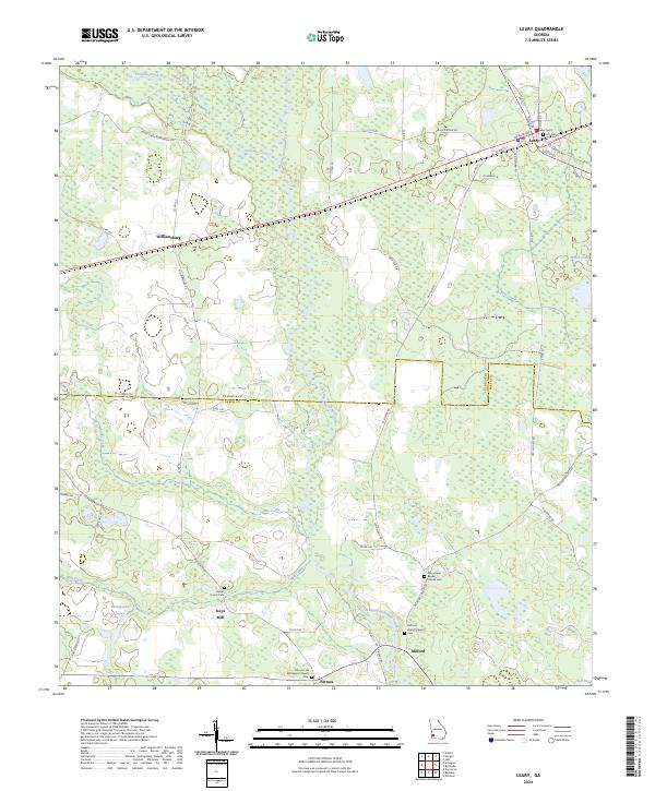
2024 Map of Leary
USGS Topo · Published 2024About this map
The town of Leary serves as the primary hub in this southwest Georgia landscape, situated where the northern agricultural fields meet the dense wetlands of the Pachitla Creek and Ichawaynochaway Creek basins. This modern survey illustrates the enduring rural structure of the area, defined by the boundary between Calhoun Co and Baker Co. Longstanding community anchors are visible in settlements like Williamsburg, Patmos, and Milford, each marked by their respective religious and burial sites. Genealogists will find significant value in the detailed plotting of local cemeteries, including the Patmos Free Will Baptist Church Cem and Macedonia Baptist Church Cem. The southern portion of the map highlights the traditional milling and water-based economy of the region, centered around Iveys Mill and the nearby Thompson Lake, illustrating how the waterway networks of Caney Creek and Mill Creek have shaped local settlement patterns over generations.
Find a feature on this map
61 named features on this map. Tap any name to fly to it.
Don’t see what you’re looking for? This feature index may not catch every label — zoom into the map to look around manually.
Map Details
Editions of this 2024 Leary Map
This is the sole edition of this map. No revisions or reprints were ever made.
Other maps of this area

1953 · Dothan
USGS Topo · 1:250,000

1954 · Dothan
USGS Topo · 1:250,000

1955 · Dothan
USGS Topo · 1:250,000

1956 · Newton
USGS Topo · 1:62,500

1956 · Sasser
USGS Topo · 1:62,500

1973 · Morgan
USGS Topo · 1:24,000
1973 · Holt
USGS Topo · 1:24,000

1973 · Edison
USGS Topo · 1:24,000

1974 · Damascus
USGS Topo · 1:24,000

1974 · Arlington
USGS Topo · 1:24,000