2023 Map of Lebam
USGS Topo · Published 2023About this map
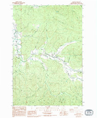
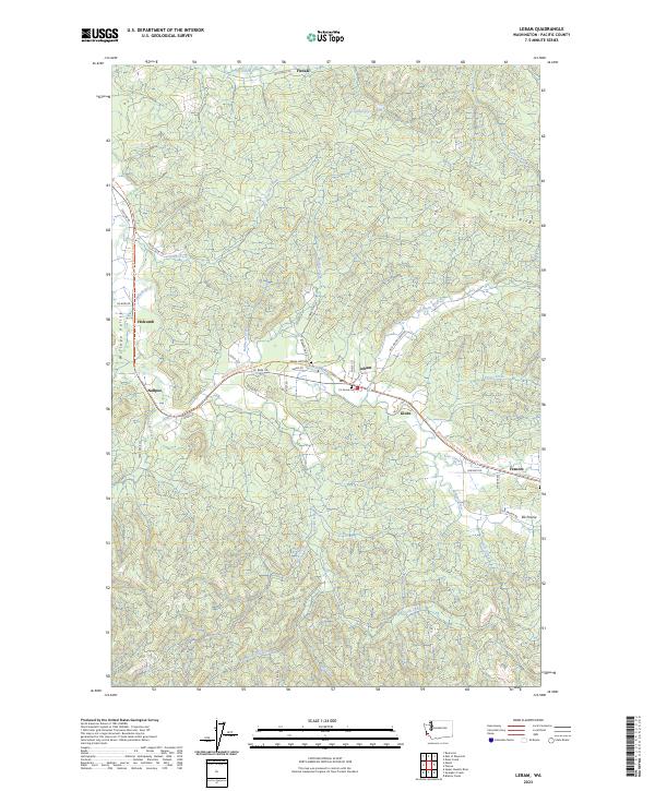
The Willapa River serves as the central artery for this portion of Pacific County, winding through the Willapa Valley and connecting a string of rural timber-country settlements. The map highlights the historic corridor along the Willapa Hills State Park Trl, which follows the path of an old rail line that once fueled the local economy. Small communities like Lebam, Frances, and Globe are clustered along this transit spine, where local landmarks such as Maple Hill Cem and Fir Grove Cem provide points of interest for genealogical researchers. Higher elevations are dominated by timberlands and ridges, most notably P and E Ridge, while the landscape is dissected by numerous drainages including Fork Creek and Half Moon Creek. The density of named creeks and family-named roads like Strozyk Rd and Bilow Rd indicates a landscape shaped by decades of forestry and homesteading.
Find a feature on this map
55 named features on this map. Tap any name to fly to it.
Don’t see what you’re looking for? This feature index may not catch every label — zoom into the map to look around manually.
Map Details
Editions of this 2023 Lebam Map
This is the sole edition of this map. No revisions or reprints were ever made.