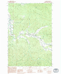
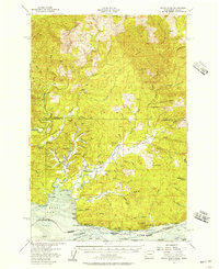
1986 Map of Lebam
USGS Topo · Published 1994About this map
The Willapa River meanders through the heart of the Willapa Valley on this mid-1980s survey, anchoring a string of small settlements that define the region's rural character. The namesake community of Lebam serves as a focal point along the river, complemented by the nearby hamlets of Holcomb, Nallpee, Willapa, and Globe. This landscape reflects an economy tied closely to the land and water, evidenced by the Fish Hatchery near Nallpee and various resource extraction sites like the Gravel Pit and Borrow Pit.
Find a feature on this map
41 named features on this map. Tap any name to fly to it.
Don’t see what you’re looking for? This feature index may not catch every label — zoom into the map to look around manually.
Map Details
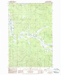
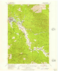
Editions of this 1986 Lebam Map
2 editions found
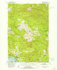
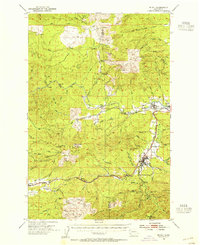
Other maps of this area

1940 · Brookfield
USGS Topo · 1:62,500

1941 · Walville
USGS Topo · 1:62,500

1941 · Skamokawa
USGS Topo · 1:62,500

1949 · Upper Naselle River
USGS Topo · 1:24,000

1953 · Hoquiam
USGS Topo · 1:250,000
1953 · Skamokawa
USGS Topo · 1:62,500
1953 · Pe Ell
USGS Topo · 1:62,500
1955 · Grays River
USGS Topo · 1:62,500
1955 · Raymond
USGS Topo · 1:62,500

1957 · Hoquiam
USGS Topo · 1:250,000