Old Maps of Pacific County, Washington
Explore 246 old maps of Pacific County, spanning from 1919 to today. These high-resolution historic maps reveal how streets, neighborhoods, landmarks, and natural features evolved over time — perfect for genealogy, metal detecting, research, and local history exploration.
What you can do with these maps:
- See how Pacific County changed over time: Compare historical maps to modern-day views to trace roads, homesites, rail lines & more.
- View detailed metadata: Each map includes creators, publishers, year, scale, and archive source.
- Overlay maps with satellite & LiDAR: Visualize the past alongside modern tools to explore terrain & human change.
- Trusted historical sources: Maps sourced from the USGS, Library of Congress, and other archives.
- Access maps your way: View online, download high-res files, or order prints for personal or research use.
Start exploring old maps of Pacific County to uncover forgotten places, hidden landmarks, and the deep history beneath your feet.
Pacific County, WA maps
(246)- 1919 Map of Astoria, 1928 Print
 1919 Astoria1928 Print · USGSCoastal Oregon at the end of the Great War reveals a busy network of military posts, rail lines, and river commerce. Genealogists and historians can trace the early footprints of Astoria and Warrenton or locate specific sites like Fort Stevens and Cullaby Lake.
 - 1938 Map of Cape Disappointment
 1938 Cape Disappointment1938 Print · USGSThe Long Beach Peninsula in the late 1930s was a bustling landscape of oyster docks, coastal ranches, and military outposts. Genealogists can trace family holdings like the Loomis Ranch or find local landmarks including the Moby Dick Hotel and Fort Canby.
 - 1938 Map of Cape Shoalwater
 1938 Cape Shoalwater1938 Print · USGSThe Washington coast in the late thirties reveals a thriving maritime and shellfish economy along the narrow peninsula between the ocean and bay. Genealogists and historians can trace family properties and coastal camps such as Oysterville, Signodson Clam Camp, and Nahcotta.
 - 1938 Map of Fort Columbia, 1957 Print
 1938 Fort Columbia1957 Print · USGSCoastal Washington and the Columbia River estuary appear in the late 1930s, showing a landscape of maritime defense and family-run ranches. Trace historic local landmarks like the Fort Columbia Military Reservation, the Peaceful Hill Cem, and the U S Quarantine Station.2 unique versions available
 - 1938 Map of South Bend, 1963 Print
 1938 South Bend1963 Print · USGSWillapa Bay and the river delta are captured here in the late 1930s, showing a landscape of maritime trade and family homesteads. Genealogists can trace property and industry via Pickernell Ranch, the Dwyer Store, and the Northern Pacific rail line.
 - 1939 Map of Astoria
 1939 Astoria1939 Print · USGSThe Columbia River mouth and Oregon coast appear here just before the Second World War, showing a landscape of maritime defense and timber industry. Genealogists can locate family-named landmarks and rural hubs like Netel Grange, Soldiers Cem, and Youngs River Falls Sch.
 - 1940 Map of Montesano
 1940 Montesano1940 Print · USGSGrays Harbor and Pacific counties were defined by a massive river-and-rail network just before the war. You can trace the path of the Northern Pacific through Montesano or locate old timber operations along the Logging lines near Arctic and Vesta.
 - 1940 Map of Brookfield
 1940 Brookfield1940 Print · USGSPacific and Wahkiakum Counties are shown in detail during the early 1940s, highlighting the heavy industrial presence along the Columbia River shoreline. Researchers can locate salmon canneries, logging camps, and family holdings such as the Pillar Rock Cannery, Old Camp Brix Logging Co, and Maki Ranch.
 - 1940 Map of South Bend
 1940 South Bend1940 Print · USGSPacific County's maritime and ranching history is preserved here during the late thirties, centered on the river port of South Bend. Genealogists and historians can locate old family landmarks like Minks Ranch, Dwyer Store, and the coastal retreat at Rhodesia Beach.
 - 1941 Map of Walville
 1941 Walville1941 Print · USGSThe timber country and rail towns of southwest Washington are captured here just before the Second World War. Researchers can trace family sites at the Habersetzer Farm, locate the Brittian-Chandler CCC Camp, or follow the Northern Pacific RR through Pe Ell.
 - 1941 Map of Skamokawa
 1941 Skamokawa1941 Print · USGSWahkiakum County's timber and river culture is captured here during the early 1940s, showing the intersection of logging camps and Columbia River fisheries. Researchers can locate family landmarks like the Oatfield Ranch, trace the Crown Willamette Headquarters Camp, or find the Fern Hill Cemetery.
 - 1941 Map of Ford
 1941 Ford1941 Print · USGSGrays Harbor County at the brink of the Second World War shows a river valley shaped by logging and rail transit. Genealogists and historians can trace the early footprints of Malone, Cedarville, and Saginaw along the banks of the Chehalis River.2 unique versions available
 - 1941 Map of Grayland
 1941 Grayland1941 Print · USGSGrays Harbor and the Washington coast are captured here just before the mobilization of the early 1940s. Genealogists and historians can trace the foundations of Westport, locate the Western Logging Co Camp, and find maritime landmarks like the Grays Harbor L H.
 - 1943 Map of Fort Columbia
 1943 Fort Columbia1943 Print · USGSThe coastal defense and river economy of Pacific County are captured here during the wartime era. Genealogists and historians can locate numerous family-named landmarks like Gile Ranch or Kyle Ranch alongside the Naselle State Salmon Hatchery and Fort Columbia.
 - 1943 Map of Copalis Beach
 1943 Copalis Beach1943 Print · USGSThe Washington coast in the 1940s is detailed here from the Olympic Peninsula to the Columbia River. Trace old beach settlements like Moclips and Copalis Beach alongside landmarks like the Willapa Bay Lighthouse.
 - 1949 Map of Astoria
 1949 Astoria1949 Print · USGSThe mouth of the Columbia River comes to life in this mid-century survey, showing the busy maritime hub of Astoria and its surrounding riverbanks. Genealogists and historians can trace the development of Navy Heights, find the Astor Column, and locate early schools like School No 26.4 unique versions available
 - 1949 Map of Chinook, 1954 Print
 1949 Chinook1954 Print · USGSThe mouth of the Columbia River and the rugged Pacific County coastline are captured here in the mid-twentieth century. Genealogists and local historians can trace family landholdings like Goulter Ranch and Beeker Ranch alongside landmarks like Stringtown and Fort Columbia Military Reservation.4 unique versions available
 - 1949 Map of Upper Naselle River, 1954 Print
 1949 Upper Naselle River1954 Print · USGSPacific and Wahkiakum counties at the end of the 1940s show a landscape shaped by the timber industry and river systems. You can trace the path of the Logging Railroad and locate work sites like the Logging Camp and Upper Naselle Ranger Sta.
 - 1949 Map of Oman Ranch, 1954 Print
 1949 Oman Ranch1954 Print · USGSCoastal Pacific County comes to life in this mid-century survey of the river valleys and tidal flats near Naselle. Genealogists can trace family-named homesteads such as Oman Ranch and Siivola Ranch alongside the Naselle State Salmon Hatchery.5 unique versions available
 - 1949 Map of Knappton, 1954 Print
 1949 Knappton1954 Print · USGSThe Columbia River shoreline and the timberlands of Pacific County are captured here just after the war. Discover the locations of the Quarantine Sta, the Old Railroad Grade, and small riverfront landings like Frankfort and Knappton.5 unique versions available
 - 1949 Map of Ocean Park, 1955 Print
 1949 Ocean Park1955 Print · USGSThe Long Beach Peninsula in the late 1940s was a landscape of coastal ranches, marshes, and small seaside communities. Researchers can trace the legacy of local families and industry through the Loomis Ranch, the Old Railroad Grade, and the Ocean Park-Nahcotta Sch.3 unique versions available
 - 1949 Map of Rosburg, 1955 Print
 1949 Rosburg1955 Print · USGSCoastal Wahkiakum County is depicted here in the late 1940s as a landscape of tidewater sloughs and river landings. Genealogists and historians can trace riverside settlements at Rosburg, Altoona, and Oneida, or locate landmarks like Old Camp Brix and the Rosburg Sch.3 unique versions available
 - 1949 Map of Long Island, 1955 Print
 1949 Long Island1955 Print · USGSThe Pacific coast of Washington reveals a landscape of tidal marshes and remote ranching life just after the war. Researchers can trace historic homesteads like Ball Ranch and Church Ranch or explore the waterways of the Willapa Migratory Bird Refuge.3 unique versions available
 - 1949 Map of Cape Disappointment, 1955 Print
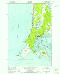 1949 Cape Disappointment1955 Print · USGSThe Washington coast at the mouth of the Columbia River comes alive in this mid-century survey of the Long Beach Peninsula. Genealogists and local historians can trace family properties like Christorf Ranch, visit the Lone Fir Cem, or locate the historic Fort Canby military grounds.4 unique versions available
 - 1951 Map of Copalis Beach
 1951 Copalis Beach1951 Print · USGSThe Olympic Peninsula's rugged coast and tribal lands are meticulously detailed in the early 1950s. Genealogists and historians can trace the foundations of coastal communities from Taholah to La Push or locate early markers like the James Island Lighthouse.
Showing maps 1-25 of 246
Top cities of Pacific County
- Raymond historical maps
- South Bend historical maps
- Ocean Park historical maps
- Long Beach historical maps
- Ilwaco historical maps
- Tokeland historical maps
Frequently asked questions
- What are the different types of historical maps available for Pacific County?
- What is the oldest map of Pacific County?
- Where can I purchase historical maps of Pacific County for my home or office?
- Where can I download high-res historical maps of Pacific County?
- Are there historical topographic maps available for Pacific County?
- Is there historical aerial imagery available for Pacific County?
- Where are historical maps of Pacific County sourced from?