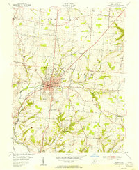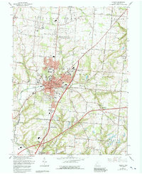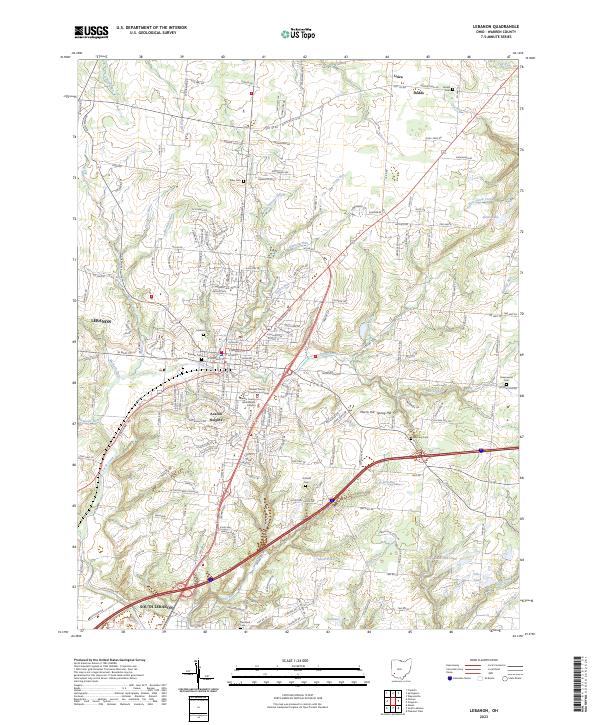
2023 Map of Lebanon
USGS Topo · Published 2023About this map
Lebanon and its surrounding Warren County landscape are meticulously documented in this 2023 survey, showing the modern layout of the seat of government alongside centuries of history. The city center is anchored by the Warren County Courthouse Annex and the Warren County Government Campus, reflecting its role as a regional administrative hub. Just south, Avalon Heights and South Lebanon mark the continued expansion of the residential corridor, while the north is defined by rural crossroads like Utica and Dodds. The map is particularly valuable for genealogists, as it preserves the locations of numerous historic burial grounds, including the Pioneer Cem, Lebanon Cem, and the more remote Hatfield Cem. The terrain is deeply etched by a network of waterways including Turtle Creek and its many tributaries, while landmarks like Stolle Lake and Spear Pond punctuate the landscape.
Find a feature on this map
184 named features on this map. Tap any name to fly to it.
Don’t see what you’re looking for? This feature index may not catch every label — zoom into the map to look around manually.
Map Details
Editions of this 2023 Lebanon Map
This is the sole edition of this map. No revisions or reprints were ever made.