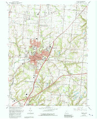
1966 Map of Lebanon
USGS Topo · Published 1992About this map
Lebanon serves as the focal point of this mid-century Warren County landscape, showing a dense network of civic and educational infrastructure. The presence of the Courthouse, City Hall, and Armory underscores its role as a regional center, while schools like Oakwood High Sch and St Francis DeSales Sch highlight the community's growth. The surrounding townships of Turtle Creek and Union are defined by a mix of agriculture and emerging suburban infrastructure, including the Penn Central railroad and aviation sites like Brownies Lebanon Airport. For genealogists, the map is particularly detailed, locating several burial grounds such as Old Stone Schoolhouse Cem and Pioneer Cem. The terrain is drained by Turtle Creek and Clear Creek, with the landscape also marked by industrial utilities including multiple pipelines and a local Gravel Pit.
Find a feature on this map
61 named features on this map. Tap any name to fly to it.
Don’t see what you’re looking for? This feature index may not catch every label — zoom into the map to look around manually.
Map Details
Editions of this 1966 Lebanon Map
4 editions found
Other maps of this area

1904 · Mason
USGS Topo · 1:62,500

1906 · Mason
USGS Topo · 1:62,500

1908 · Miamisburg
USGS Topo · 1:62,500

1913 · Waynesville
USGS Topo · 1:62,500

1914 · Morrow
USGS Topo · 1:62,500

1915 · Waynesville
USGS Topo · 1:62,500

1916 · Morrow
USGS Topo · 1:62,500

1951 · Franklin
USGS Topo · 1:24,000

1953 · Cincinnati
USGS Topo · 1:250,000

1955 · Monroe
USGS Topo · 1:24,000