Loading...
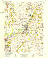
Loading map...1951 Map of Franklin
USGS Topo · Published 1953About this map
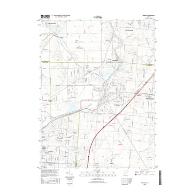
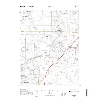
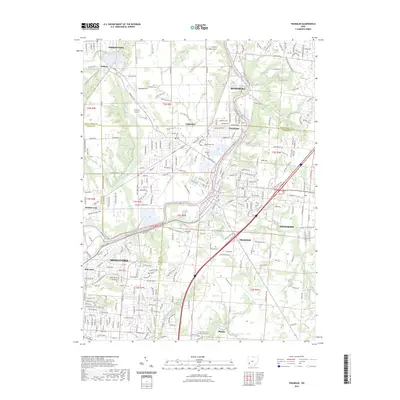
The Miami River corridor defines the industrial and social character of this 1951 survey, where the New York Central and Baltimore and Ohio railroads converge near the municipal hubs of Franklin and Middletown. To the north, the riverside community of Chautauqua sits across from a prominent power plant, while local transport is facilitated by a network of rural routes including Swartzel Road and Pennyroyal Road.
Find a feature on this map
46 named features on this map. Tap any name to fly to it.
Don’t see what you’re looking for? This feature index may not catch every label — zoom into the map to look around manually.
Map Details
Date Portrayed1951
Date Published1953
PublisherU.S. Geological Survey
Map TypeTopographic
Scale1:24,000
Physical Dimensions22 x 26.8 inches
Editions of this 1951 Franklin Map
This is the sole edition of this map. No revisions or reprints were ever made.
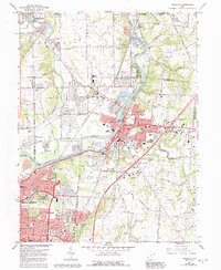
Historical Maps of Middletown Through Time
7 maps found
Featured Locations
Source Details
SourceU.S. Geological Survey
CopyrightPublic Domain