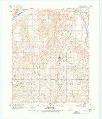
1961 Map of Leedey
USGS Topo · Published 1978About this map
The Leedey townsite serves as the central hub of this Western Oklahoma landscape, positioned at the intersection of the Missouri-Kansas-Texas rail line. The terrain is defined by a dense network of drainages including Barnitz Creek and Quartermaster Creek, which cut through the red-soils country of the Dewey, Custer, and Roger Mills county borders. This era of the early 1960s captures the rural community structure before modern consolidation, evidenced by the distribution of country schools and houses of worship like the Liberty Center School and Center Chapel. Small water bodies such as Leedey Lake and Mabry Lake provide rare catchments in a region primarily drained by the wide Canadian River to the north. Numerous cemeteries, including Evergreen Cem and the New Herman Cem, offer valuable geographic anchors for genealogical research into the families that settled this portion of the Oklahoma panhandle's approach.
Find a feature on this map
38 named features on this map. Tap any name to fly to it.
Don’t see what you’re looking for? This feature index may not catch every label — zoom into the map to look around manually.
Map Details
Editions of this 1961 Leedey Map
2 editions found
Other maps of this area

1955 · Clinton
USGS Topo · 1:250,000

1955 · Woodward
USGS Topo · 1:250,000

1957 · Clinton
USGS Topo · 1:250,000

1957 · Butler
USGS Topo · 1:62,500

1958 · Woodward
USGS Topo · 1:250,000

1960 · Cheyenne
USGS Topo · 1:62,500

1960 · Hammon
USGS Topo · 1:62,500

1961 · Leedey
USGS Topo · 1:62,500

1962 · Aledo
USGS Topo · 1:62,500

1965 · Roll NE
USGS Topo · 1:24,000