
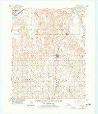
1961 Map of Leedey
USGS Topo · Published 1963About this map
Leedey serves as the central hub of this Western Oklahoma landscape, positioned where the Kansas Texas and Missouri Railroad cuts through the rolling terrain. The map reveals a deeply rooted rural society defined by small community centers and family burial grounds such as Evergreen Cem and Shirley Cem. Water management is central to the area's geography, with the Canadian River anchoring the northern and eastern borders, complemented by local landmarks like Leedey Lake and Mabry Lake.
Find a feature on this map
35 named features on this map. Tap any name to fly to it.
Don’t see what you’re looking for? This feature index may not catch every label — zoom into the map to look around manually.
Map Details
Editions of this 1961 Leedey Map
2 editions found
Other maps of this area

1955 · Clinton
USGS Topo · 1:250,000

1955 · Woodward
USGS Topo · 1:250,000

1957 · Clinton
USGS Topo · 1:250,000

1957 · Butler
USGS Topo · 1:62,500

1958 · Woodward
USGS Topo · 1:250,000

1960 · Cheyenne
USGS Topo · 1:62,500

1960 · Hammon
USGS Topo · 1:62,500

1962 · Aledo
USGS Topo · 1:62,500

1965 · Roll NE
USGS Topo · 1:24,000

1966 · Roll SE
USGS Topo · 1:24,000