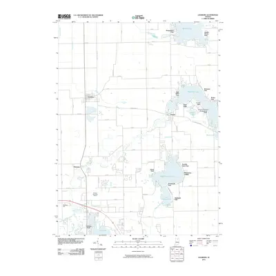
2010 Map of Leesburg
USGS Topo · Published 2010About this map
Tippecanoe Lake and Big Chapman Lake anchor this 2010 survey of Kosciusko County, where the landscape is defined by a dense network of glacial lakes and drainage systems. Small settlements like Leesburg and Oswego sit atop the glacial till, connected by a rigid grid of country roads that contrast with the meandering path of the Tippecanoe River. The area serves as a significant recreational and residential hub, evidenced by numerous named lakefront developments and parks such as Potawatomi Park, Forest Glen, and Stoneburner Landing. To the south, the expansion of the Warsaw Municipal Airport and the presence of Lakeside Park near Pike Lake show the intersection of local infrastructure with the natural wetlands. This map provides a detailed look at the modern shoreline and local drainage through features like Ruple Ditch and Heeter Ditch, reflecting the managed water levels essential to the region's geography.
Find a feature on this map
73 named features on this map. Tap any name to fly to it.
Don’t see what you’re looking for? This feature index may not catch every label — zoom into the map to look around manually.
Map Details
Editions of this 2010 Leesburg Map
This is the sole edition of this map. No revisions or reprints were ever made.
Other maps of this area

1950 · Leesburg
USGS Topo · 1:24,000

1950 · Pierceton
USGS Topo · 1:24,000

1950 · North Webster
USGS Topo · 1:24,000

1951 · Milford
USGS Topo · 1:24,000

1951 · Wawasee
USGS Topo · 1:24,000

1953 · Fort Wayne
USGS Topo · 1:250,000

1956 · Fort Wayne
USGS Topo · 1:250,000

1957 · Warsaw
USGS Topo · 1:24,000

1958 · Nappanee East
USGS Topo · 1:24,000

1959 · Atwood
USGS Topo · 1:24,000