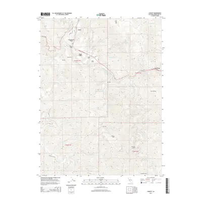
2015 Map of Leggett
USGS Topo · Published 2015About this map
Leggett and its surrounding communities are anchored by the South Fork Eel River as it winds through this northern Mendocino County landscape. The settlement pattern here follows the narrow valleys and flats, with Underwood Park, South Leggett, and Leggett Valley clustered near the junction of major corridors like N Highway 1 and Ca-271. The terrain is defined by dramatic elevation changes, rising toward Little Red Mtn in the north and the expansive Elkhorn Ridge to the south. Local topography is further marked by distinctive named features such as Big Bend and Pedro Opening, while small drainages like Big Dann Cr and Hollow Tree Cr carve the slopes. This survey provides a clear view of the residential pockets at Winkie Flat, Cedar Flat, and the more eastern settlement at Cummings, illustrating how the geography has dictated the placement of roads and small communities within this timber-rich region.
Find a feature on this map
49 named features on this map. Tap any name to fly to it.
Don’t see what you’re looking for? This feature index may not catch every label — zoom into the map to look around manually.
Map Details
Editions of this 2015 Leggett Map
This is the sole edition of this map. No revisions or reprints were ever made.
Other maps of this area

1920 · Cummings
USGS Topo · 1:62,500

1921 · Westport
USGS Topo · 1:62,500

1921 · Branscomb
USGS Topo · 1:62,500

1950 · Piercy
USGS Topo · 1:62,500

1950 · Cape Vizcaino
USGS Topo · 1:62,500

1951 · Cape Vizcaino
USGS Topo · 1:62,500

1951 · Branscomb
USGS Topo · 1:62,500

1952 · Leggett
USGS Topo · 1:62,500

1957 · Ukiah
USGS Topo · 1:250,000

1960 · Ukiah
USGS Topo · 1:250,000