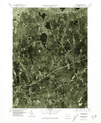
1975 Map of Leicester
USGS Topo · Published 1981About this map
Forests and small-scale agriculture dominate the landscape between Spencer and Leicester in this mid-1970s orthophotoquad. Unlike traditional line-drawn maps, this aerial perspective reveals the exact footprint of central Massachusetts mill villages and expanding residential corridors during a period of transition. The dense clusters of Rochdale and Greenville are clearly visible alongside the winding secondary roads that connect these historic settlements. Further south, the map details the layout of Charlton and Charlton City, showing the relationship between established town centers and the encroaching wooded areas. The inclusion of Mystic Grove and North Oxford provides a look at the early phases of suburban infill, where new developments began to intersect with the region's traditional industrial and agricultural roots.
Find a feature on this map
8 named features on this map. Tap any name to fly to it.
Don’t see what you’re looking for? This feature index may not catch every label — zoom into the map to look around manually.
Map Details
Editions of this 1975 Leicester Map
This is the sole edition of this map. No revisions or reprints were ever made.
Other maps of this area

1885 · Worcester
USGS Topo · 1:62,500

1886 · Worcester
USGS Topo · 1:62,500

1887 · Brookfield
USGS Topo · 1:62,500

1887 · Barre
USGS Topo · 1:62,500

1889 · Webster
USGS Topo · 1:62,500

1889 · Barre
USGS Topo · 1:62,500

1890 · Brookfield
USGS Topo · 1:62,500

1892 · Webster
USGS Topo · 1:62,500

1892 · Worcester
USGS Topo · 1:62,500

1893 · Brookfield
USGS Topo · 1:62,500