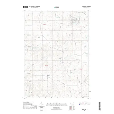
2018 Map of Leisure Lake
USGS Topo · Published 2018About this map
Crab Town and its surrounding countryside in Jackson County are defined by the winding course of the North Fork Maquoketa River and a dense network of family-named cemeteries. This area showcases a traditional rural Iowa settlement pattern where small clusters like South Garry Owen and Ironhills serve as anchors for the local farming community. The topography is notably marked by the Ozark Springs and the preserved lands of the Ozark Wildlife Area, highlighting the natural drainage systems of Pine Cr and Black Hawk Cr. Genealogists will find significant value in the numerous burial sites across the township, including Saint Aloysius Cem, Hickory Grove Cem, and the Griffin Estate Cem, which point to the established lineages that have maintained this landscape for generations.
Find a feature on this map
81 named features on this map. Tap any name to fly to it.
Don’t see what you’re looking for? This feature index may not catch every label — zoom into the map to look around manually.
Map Details
Editions of this 2018 Leisure Lake Map
This is the sole edition of this map. No revisions or reprints were ever made.
Other maps of this area

1891 · Maquoketa
USGS Topo · 1:62,500

1891 · Baldwin
USGS Topo · 1:62,500

1901 · Peosta
USGS Topo · 1:125,000

1935 · East Dubuque
USGS Topo · 1:62,500

1940 · East Dubuque
USGS Topo · 1:62,500

1959 · Dubuque
USGS Topo · 1:250,000

1961 · Dubuque
USGS Topo · 1:250,000

1962 · Dubuque
USGS Topo · 1:250,000

1962 · Zwingle
USGS Topo · 1:24,000
1966 · Bernard
USGS Topo · 1:24,000